Discover Washington State’s hidden gems beyond Seattle and Mount Rainier. From secret Olympic Peninsula rainforests to Eastern Washington ghost towns, explore the Pacific Northwest’s best-kept secrets that most tourists never see.
Keywords: Washington State hidden gems, Olympic National Park secrets, San Juan Islands hidden spots, North Cascades hiking, Washington ghost towns, Pacific Northwest off the beaten path, Washington State waterfalls, hot springs Washington
Introduction: Beyond the Iconic Views
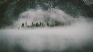
Washington State holds a special kind of magic that goes far beyond Seattle’s Space Needle or Mount Rainier’s iconic silhouette. While millions flock to these well-known destinations each year, the Pacific Northwest harbors secrets that even many locals haven’t discovered. Having spent years exploring every corner of this diverse state, I’ve learned that Washington’s true character reveals itself in the quiet moments—misty mornings in ancient rainforests, abandoned mining towns whispering stories of the past, and coastal beaches where the only footprints in the sand are your own.
This isn’t your typical travel guide. We’re venturing beyond the postcard locations into Washington’s soul. From the moss-draped canyons of the Olympic Peninsula to the ghost towns that dot Eastern Washington’s rolling hills, these hidden gems reward those willing to venture off the beaten path. Whether you’re a seasoned Washington resident or a first-time visitor looking for something extraordinary, this guide will introduce you to the places that make the Pacific Northwest truly unforgettable.
The best part? Most of these spots remain surprisingly uncrowded year-round, offering authentic experiences that feel like your own private discovery.

Pack your sense of adventure (and good rain gear)—we’re about to explore Washington’s best-kept secrets.
Olympic National Park: Beyond Hurricane Ridge
The Quiet Magic of the Queets River
While Hurricane Ridge draws crowds with its panoramic views, the Queets River Valley offers Olympic National Park’s most pristine rainforest experience—without the tourist buses. Tucked away in the park’s southwest corner, this remote valley receives less than 10% of the park’s annual visitors, yet it contains some of the most spectacular old-growth forests you’ll ever encounter.
The Queets River Trail winds through groves of Western redcedars and Douglas firs that have stood for over 500 years. Some trees measure more than 12 feet in diameter, their canopies so dense they create an emerald twilight even at midday. Ferns carpet the forest floor in endless patterns of green, while the Queets River thunders nearby, carrying glacial melt from the Olympic Mountains.
Getting There: The trailhead requires navigating 15 miles of gravel road (Upper Queets River Road), which can be rough after rain. A high-clearance vehicle helps, though careful drivers manage in standard cars during dry months. The road dead-ends at the trailhead, where a backcountry permit is required for overnight stays.
Best Time to Visit: Late July through September offers the driest conditions and clearest hiking. Spring brings spectacular wildflower displays but also swollen rivers that can make trail crossings dangerous.

Insider Tip: The trail becomes more challenging after three miles, with multiple river crossings that require wading. Bring trekking poles and water shoes, and always check river conditions before attempting crossings. The first two miles offer the most accessible old-growth scenery if you prefer to stay dry.
Ruby Beach’s Secret Neighbor: Third Beach
Ruby Beach earns every bit of its fame, but its southern neighbor, Third Beach, delivers the same dramatic coastline with a fraction of the crowds. Part of Olympic National Park’s coastal strip, Third Beach offers something rare on the Pacific coast: a manageable hike to a pristine wilderness beach that feels completely removed from civilization.
The 1.4-mile trail winds through coastal forest before emerging onto a sweeping crescent of sand backed by towering sea stacks. During low tide, you can explore tide pools teeming with purple sea stars, giant green anemones, and bright orange ochre sea stars. The beach stretches for two miles, providing ample space to find your own slice of paradise.
What Makes It Special: Third Beach marks the beginning of the most spectacular section of Olympic’s wilderness coast. Southward lies the legendary “Shipwreck Coast,” where the remains of the SS Catala lie buried in the sand (visible only during extreme low tides). To the north, dramatic headlands create intimate coves accessible only during low tide.
Camping: A wilderness permit allows overnight camping on the beach, where falling asleep to Pacific waves ranks among life’s great pleasures. Bear canisters are mandatory—the black bears here have learned that backpackers mean food.
Essential Gear: Washington’s coastal weather changes rapidly. A quality rain shell like the Patagonia Torrentshell 3L Jacket provides reliable protection from sudden squalls. Temperature swings between sun and fog can exceed 20°F—dress in layers and always carry an extra warm layer.
San Juan Islands: Beyond Friday Harbor
Sucia Island’s Hidden Coves
While Friday Harbor hums with tourists and whale-watching boats, Sucia Island State Park offers the San Juan Islands’ most remote and rewarding experience. This horseshoe-shaped island, accessible only by private boat or water taxi, contains some of the most fascinating geology in the entire archipelago.
Sucia’s name derives from the Spanish word for “dirty”—a reference to the treacherous reefs and hidden rocks that have claimed countless ships since the 1700s. Today, those same geological features create a coastline of endless discovery. Erosion has sculpted sandstone into fantastic shapes, while hidden coves reveal themselves at low tide, each one more secluded than the last.
Fossil Bay: The island’s main anchorage earns its name from the abundant marine fossils embedded in the sandstone cliffs. Ammonites, clams, and other ancient creatures lie exposed in the rock layers, easily found with careful observation. Remember—look but don’t touch. Collecting fossils is prohibited in Washington State Parks.
Hiking: Sucia’s trail network covers about 10 miles, winding through madrona forests and along dramatic cliffs. The loop around Mount Erie offers sweeping views of the Strait of Juan de Fuca and the Canadian Gulf Islands. On clear days, you can see Mount Baker rising like a white pyramid to the east.
Camping: The island’s 60 campsites fill quickly in summer, but shoulder season visits (May-June, September-October) offer peaceful solitude. All sites are first-come, first-served—arrive by Thursday for weekend visits during peak season.
Getting There: The most reliable access is through Blaine or Anacortes marinas. Several companies offer water taxi service and kayak rentals. Kayaking around Sucia’s perimeter takes a full day but reveals hidden sea caves and arches impossible to see from land.
Lime Kiln Point’s Alternative: Cattle Point
While everyone crowds Lime Kiln Point for whale watching, Cattle Point on San Juan Island’s southern tip delivers equally spectacular marine mammal viewing without the crowds. Here, the Haro Strait’s nutrient-rich waters support three resident orca pods, and the point’s elevation provides perfect vantage for spotting their distinctive dorsal fins.
The historic Cattle Point Lighthouse (built 1935) stands guard over exposed rocks and reefs where harbor seals haul out in massive numbers. Bring binoculars—like these Nikon Prostaff P7 Binoculars—to spot porpoises, minke whales, and occasionally humpbacks passing through the strait. The kelp forests offshore host sea otters, reintroduced successfully since the 1960s.
Photography Tip: Golden hour here transforms the landscape—Mount Baker glows pink across the water while the Olympic Peninsula creates a dramatic backdrop. A Sony Alpha 7 IV camera captures the dynamic range between dark sea stacks and bright sunset skies.
Birdwatching Bonus: The point lies on a major migratory flyway. Fall brings thousands of scoters, grebes, and loons. Winter offers opportunities to see rare species like yellow-billed loons that occasionally stray from their Arctic range.
North Cascades: The American Alps
Hidden Lake Peaks’ Alpine Paradise
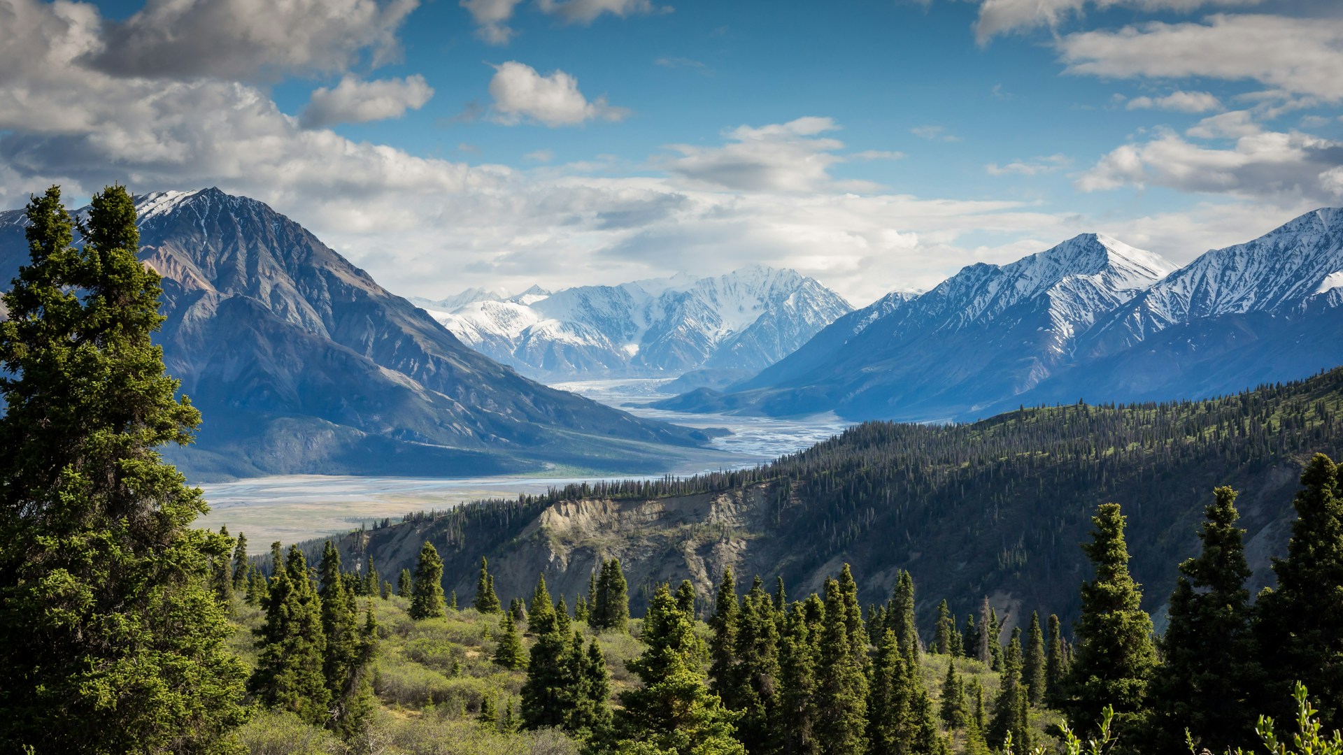
The North Cascades Highway (State Route 20) closes each winter, isolating some of Washington’s most spectacular terrain. Hidden Lake Peaks offers everything that makes the North Cascades legendary—glaciated peaks, pristine alpine lakes, and jaw-dropping views—yet receives surprisingly few visitors compared to popular spots like Diablo Lake.
The trail to Hidden Lake Lookout climbs steadily through subalpine meadows before reaching the historic fire lookout at 6,900 feet. From this vantage, the entire North Cascades sprawls before you: glaciated summits stretch to the horizon, while Hidden Lake gleams like a sapphire in the granite basin below.
What Makes It Special: This is prime mountain goat habitat, and you’ll likely encounter these sure-footed climbers navigating impossible-looking cliffs. Marmots whistle warnings from rocky outcrops, while pikas gather vegetation in the scree fields. The lookout itself, built in 1931, is available for overnight rental through the Forest Service lottery system—spending the night here ranks among the West’s most unforgettable wilderness experiences.
Best Time to Visit: Late July through September. The trail remains snowbound until mid-July most years, and early summer brings voracious mosquitoes. September offers crisp days, fall color in the heather, and dramatically fewer visitors.
Trail Details: 5.5 miles round trip, 2,700 feet of elevation gain. The final mile climbs steeply—save energy for the push to the lookout. The trail is well-maintained but rocky; proper footwear is essential.
Gear Recommendation: The varied terrain demands versatile footwear. Merrell Moab 3 Mid Waterproof Hiking Boots provide ankle support for scree fields while remaining comfortable on the approach. Waterproof construction handles the inevitable stream crossings and morning dew on the trail.
Winchester Mountain: Easy Access to Epic Views
For big views with moderate effort, Winchester Mountain delivers exceptional return on investment. The historic fire lookout, perched at 6,521 feet, offers one of the North Cascades’ most spectacular panoramas, yet the hike reaches just 2.5 miles round trip with only 1,300 feet of elevation gain.
The trail climbs through wildflower meadows that burst with color in late July—paintbrush, lupine, and columbine create a natural garden against a backdrop of jagged peaks. As you ascend, views expand dramatically: Mount Baker to the west, Mount Shuksan to the north, and endless ridges stretching into British Columbia.
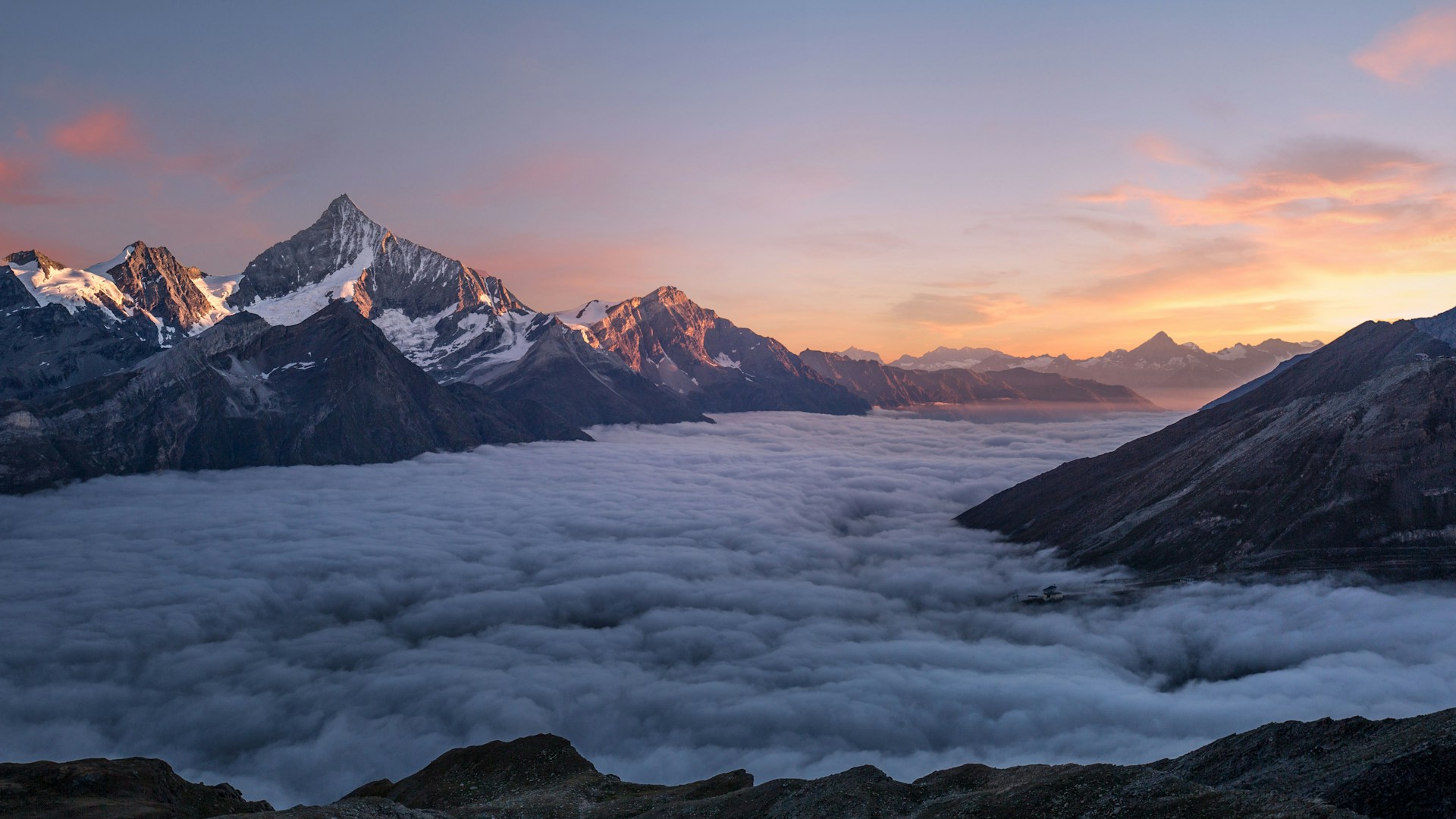
What Sets It Apart: The restored lookout, built in 1935, is open to the public on a first-come, first-served basis. Spending the night here watching sunset fade into alpenglow, then sunrise paint the peaks gold, is bucket-list material. The lookout’s limited amenities (a wood stove, four bunks) only add to its backcountry charm.
Access: The final three miles to the trailhead require high-clearance vehicles, and the road can be rough. Most visitors park at the Aster Lake trailhead and walk the road, adding 3 miles each way. This extra effort filters out crowds effectively—you’ll likely have the mountain to yourself even on summer weekends.
Photography Secret: The summit faces southeast, making it ideal for sunrise photography. The classic shot captures Mount Baker glowing first, with the lookout silhouette in the foreground. Plan to arrive 45 minutes before sunrise to set up in the dark.
Eastern Washington: Ghost Towns and Desert Wonders
Bodie: Washington’s Best-Preserved Ghost Town
While California’s Bodie gets all the glory, Washington’s Bodie (near the Okanogan Highlands) offers an authentic ghost town experience without the entrance fees or crowds. This former mining community peaked in the 1890s when gold, silver, and lead drew thousands to these rugged hills. Today, weathered buildings stand as silent witnesses to boom-and-bust cycles that defined the American West.
Unlike many “ghost towns” that have been commercialized into theme parks, Bodie remains raw and real. Collapsed cabins, mine entrances, and rusted equipment lie scattered across the landscape, exactly where miners left them a century ago. Informational panels tell stories of hardship, hope, and the harsh realities of frontier life.
Exploring the Site: The townsite sits on Bureau of Land Management land, open to respectful exploration. Several buildings remain standing, including the mill, general store, and numerous residences. Please practice historic preservation ethics—take nothing but photographs, leave nothing but footprints.
Getting There: Located 20 miles north of Republic, Washington, the final 10 miles involve gravel roads that become challenging after rain. Spring and fall offer the best conditions—summer brings heat that makes the exposed site brutal, while winter snow can block access entirely.
Pro Tip: Combine Bodie with a visit to Republic, the charming nearby town that serves as a base for exploring the area’s rich mining history. The Stonerose Interpretive Center in Republic offers world-class fossil hunting—you can keep what you find!
Gear for Desert Exploration: Eastern Washington’s high desert demands different preparation than the wet west side. Sun protection is critical, and water sources are scarce. Carry at least 3 liters per person for full-day explorations. A good GPS device provides backup navigation—cell service disappears quickly in these remote areas.
Palouse Falls: Washington’s Hidden Grand Canyon
Most Washington visitors head to Snoqualmie Falls, but Palouse Falls offers something more dramatic and far less crowded. Here, the Palouse River plunges 198 feet into a cataclysmic basalt canyon, creating a spectacle that rivals anything in the national park system.
The falls’ power comes from the Missoula Floods that scoured Eastern Washington at the end of the last ice age. These massive floods stripped away soil, exposing the basalt columns that frame the falls today. The result is a geological amphitheater of black rock, white water, and startlingly green vegetation that defies the surrounding desert.
Best Viewing Spots: The main overlook offers easy access and classic views, but adventurous hikers can scramble down to the riverbed for an entirely different perspective. The trail is steep and unmaintained—trekking poles help, and sturdy boots are non-negotiable. Swimming is prohibited and extremely dangerous due to powerful currents.
Photography Tips: The falls face east, making morning light ideal. Overcast days actually work better than bright sunshine—the soft light prevents harsh contrast and allows longer exposures to capture the water’s silky motion. A tripod and neutral density filter enable that classic flowing-water look.
Camping: Palouse Falls State Park’s primitive campground offers 16 sites (first-come, first-served) with sweeping canyon views. The park stays open year-round, though winter visits require chains or 4WD. Stargazing here is exceptional—Eastern Washington’s dark skies reveal the Milky Way in astonishing detail.
Timing: Spring (April-May) brings peak flow as snowmelt swells the river. Summer offers warm temperatures for camping but reduced water volume. Fall colors (late October) add dramatic contrast to the dark basalt.

Coastal Secrets: Beaches Beyond Ruby Beach
Shi Shi Beach: The End of the World
Located within the Makah Reservation at the northwest tip of the Olympic Peninsula, Shi Shi Beach (pronounced “shy shy”) offers the most spectacular coastal hiking in Washington—if you’re willing to earn it. The 3.3-mile trail to the beach winds through coastal forest before emerging onto a crescent of pristine sand that stretches toward Point of Arches.
What makes Shi Shi truly special is Point of Arches, a collection of sea stacks and arches that rival Thailand’s most famous limestone formations. During low tide, you can walk among these monoliths, exploring tide pools and hidden caves carved by centuries of relentless Pacific surf. The sheer scale demands superlatives—these formations rise 100 feet from the water, creating a natural cathedral of stone.
Permits and Access: Two crucial details: First, you’ll need a Makah Recreation Pass ($10 annually), available at the Makah Museum in Neah Bay or various outlets in town. Second, the trail includes a steep descent to the beach—returning uphill requires reasonable fitness. Most visitors camp overnight (wilderness permit required from Olympic National Park) to fully explore the area.
Wildlife: Shi Shi lies along major migratory routes. Spring brings gray whales passing close to shore. Summer offers harbor seals and their pups hauled out on offshore rocks. Fall welcomes sea ducks and loons in their thousands. Bald eagles are common year-round.
Camping: Beach camping is permitted above the high-tide line. The Makah Tribe manages the section south of Point of Arches, while Olympic National Park manages the northern section. Know which jurisdiction you’re in—regulations differ slightly regarding fires, food storage, and waste disposal.
Photography: Sunset at Point of Arches delivers life-changing imagery. The sea stacks silhouetted against a burning sky create compositions that seem impossible. Plan your visit around low tide to access the best vantage points among the arches.
Cape Alava: The Westernmost Point
While most visitors crowd Ozette’s main boardwalk, few continue to Cape Alava, the westernmost point in the contiguous United States. This extra mile of hiking (each way) rewards you with dramatic coastal scenery, ancient Makah history, and profound solitude.
The trail follows a historic cedar plank boardwalk through coastal swamp before reaching the beach. Turn south and walk about a mile to reach Ozette Village, an archaeological site preserving a Makah whaling village buried by a mudslide 500 years ago. Excavated artifacts are displayed at the Makah Museum in Neah Bay, but seeing the site itself connects you viscerally to thousands of years of human history.
What Makes It Special: Cape Alava feels like the edge of the world. Looking west, there’s nothing between you and Japan except open ocean. Winter storms generate massive waves that detonate against sea stacks with thunderous force. Summer brings surreal calm—days when the Pacific sleeps like a giant lake.
Wildlife Viewing: Sea otters, reintroduced in the 1970s, have rebounded dramatically here. Rafts of 50+ animals are common, often wrapped in kelp beds to prevent drifting while they sleep. Harbor seals haul out on offshore rocks, and gray whales pass close to shore during spring migration.
Practical Details: The round-trip hike covers about 12 miles when you include the coastal loop from Ozette. A wilderness permit is required for camping. The boardwalk can be extremely slick when wet—take your time and avoid running. Several sections have become damaged; be prepared for some muddy bypass trails.
Rainforest Trails: Beyond the Hoh
Quinault Rain Forest: The Valley of the Giants
While the Hoh River Valley draws the crowds, the Quinault Rain Forest offers an equally spectacular old-growth experience with a fraction of the visitors. Located in Olympic National Park’s southwest corner, Quinault contains some of the largest trees in the world—a Western redcedar here measured 175 feet tall with a 63-foot circumference before falling in 2016.
The Quinault Loop Trail provides an accessible introduction to this enchanted landscape. This 4-mile route winds through truly ancient forest, past the world’s largest Sitka spruce (191 feet tall, 585 years old) and Douglas fir giants that seem to pierce the sky. The trail crosses cascading creeks and passes along the shores of Lake Quinault, where the reflections of towering mountains create perfect mirror images on calm mornings.
World’s Largest Recorded Trees: The Quinault Valley holds records for multiple species:
– Western Redcedar: 174 feet tall, 63-foot circumference (former record holder)
– Sitka Spruce: 191 feet tall, 585 years old (still standing)
– Douglas Fir: Multiple specimens over 300 feet tall
– Western Hemlock: Several trees approaching 200 feet
Insider Access: The Quinault Rain Forest Nativity Scenic Byway provides a 31-mile loop through the area, with numerous trailheads and pullouts. Stop at the Quinault Rain Forest Ranger Station for current conditions and recommendations—the rangers here know hidden spots that don’t appear on any map.
Lodging: Lake Quinault Lodge offers historic accommodations with stunning lake views. Built in 1926, the lodge captures the rustic elegance of early 20th-century wilderness resorts. Dining here featuring local salmon and foraged mushrooms makes for a perfect post-hike meal.
When to Visit: Year-round access, though winter brings serious rainfall—expect 12+ inches monthly. September and October offer the driest conditions and spectacular fall color in the bigleaf maples. Spring delivers wildflowers and waterfalls swollen with snowmelt.
Bogachiel River Valley: The Raincrowd Alternative
The Bogachiel River Trail offers serious hikers an authentic rainforest experience without the Hoh’s crowds. This trail follows the Bogachiel River through true old-growth forest, gaining elevation gradually toward the heart of Olympic National Park’s wilderness.
What sets the Bogachiel apart is its wildness factor—this is not a maintained trail for casual tourists. Expect muddy sections, blown-down trees, and boot-sucking creek crossings. But that challenge delivers rewards: unparalleled solitude, pristine old growth, and excellent wildlife viewing. Roosevelt elk are commonly seen grazing in riverside meadows, while black bears forage in the berry thickets during late summer.
Trail Details: The first 5 miles remain relatively level, following an old roadbed that makes for easy walking. Beyond that, the trail becomes progressively more primitive as it enters the park’s designated wilderness. Most day hikers turn around between miles 5-8, finding plenty of scenery without committing to the full approach to Bogachiel Peak.
Getting There: The trailhead lies outside the park boundary in the Bogachiel State Park, requiring no entrance fee. Drive US-101 west from Port Angeles for about 12 miles, then follow the signs. The road can be rough—high clearance helps, though careful drivers manage in standard cars.
Camping: Dispersed camping is permitted along the trail’s first few miles (outside the national park boundary). Once inside the park, wilderness regulations apply, including bear canisters for food storage. The area sees very little overnight use—don’t expect to see other campers.
Wildlife Photography: The Bogachiel Valley offers some of Olympic’s best Roosevelt elk viewing, especially during the September rut. Bring a telephoto lens—these magnificent animals are surprisingly approachable but always maintain a respectful distance. Early morning and late evening provide the best lighting and animal activity.
Washington’s Secret Hot Springs
Scooteney Hot Springs: Eastern Washington’s Geothermal Gem
While most Washington hot springs enthusiasts head to Olympic or Baker, Scooteney Hot Springs near Othello offers a geothermal experience without the crowds. These natural pools emerge from the desert floor at 104°F, creating surreal contrast between hot water and cold sagebrush.
The springs consist of several pools of varying temperatures, allowing you to find your perfect temperature. The largest pool accommodates 8-10 people comfortably, while smaller pools offer more intimate soaking experiences. All pools are lined with natural stones and offer views across the desert toward the distant Saddle Mountains.
Access and Season: Scooteney remains accessible year-round, though winter requires 4WD and possibly chains for the final approach. Spring offers prime conditions—warm days for soaking, cool nights for stargazing, and wildflowers carpeting the desert floor. Summer temperatures often exceed 100°F, making hot springs soaking less appealing.
What to Bring: The springs are primitive—no changing rooms, no toilets, no trash service. Practice strict leave-no-trace principles: pack out everything you bring, including toilet paper. Bring plenty of water (at least 1 gallon per person) for drinking and rinsing off after soaking. A camping shovel is essential for proper waste disposal.
Camping: Dispersed camping is permitted on surrounding BLM land. The area attracts a respectful crowd of serious hot springs enthusiasts—expect a quiet, contemplative atmosphere rather than a party scene. Weekdays offer the best chance of solitude.
Important Note: Water quality can vary—always check current conditions on hot springs forums before visiting. Avoid soaking if you have open wounds, and never drink the water.
Baker Hot Springs: The Perfect Winter Soak
Located near Mount Baker, Baker Hot Springs offers year-round soaking in a spectacular alpine setting. The main pool maintains a comfortable 100-104°F, while smaller pools allow temperature regulation by adding cold creek water.
What makes Baker special is its winter accessibility—the snowshoe or ski in (2.5 miles each way) transforms the experience into something magical. Arriving to steaming pools while snow covers everything around you feels genuinely transcendent. The contrast between hot water, cold air, and snow-covered forest creates one of Washington’s most memorable outdoor experiences.
Summer Access: When snow-free, the road reaches within a quarter-mile of the springs. Summer visitors can combine soaking with hiking the surrounding Mount Baker wilderness, climbing nearby peaks, or exploring the extensive trail network.
Crowd Factor: Baker has grown more popular in recent years. For the best experience, arrive early morning or midweek. Winter naturally filters crowds—the effort required to reach the springs keeps casual visitors away.
Essential Gear: Proper footwear for the approach is crucial. Summer calls for hiking boots or sturdy sandals, while winter demands snowshoes with good traction. Always bring layers—the transition from hot water to cold air can be shocking, especially in winter. A Big Agnes Copper Spur HV UL2 Tent provides comfortable camping if you decide to stay overnight.
Water Quality: The flow varies seasonally—higher flow in spring means cleaner pools. Always check recent reports on soaking websites, and use your judgment about water clarity and smell before committing to a soak.
Waterfalls Beyond Snoqualmie
Sol Duc Falls: Rainforest Royalty
While Snoqualmie Falls draws millions with its easy access, Sol Duc Falls offers Olympic National Park’s most spectacular waterfall experience in a pristine old-growth forest setting. The Sol Duc River splits around a prominent basalt outcrop, creating two channels that plunge 40 feet into a foaming turquoise pool below.
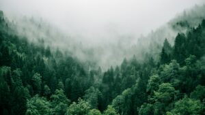
The 0.8-mile trail to the falls is a destination in itself, winding through truly ancient forest. Western hemlocks and Douglas firs exceeding 300 feet tall create a canopy so dense that the forest floor remains dim even on bright days. Every surface drips with moss—trees, rocks, fallen logs all wear thick green coats that seem to glow in the diffuse light.
Photography Secrets: The falls face north, receiving even light throughout most of the day. Overcast conditions provide the best lighting—soft illumination prevents harsh contrast in the water’s white foam. A tripod allows longer exposures (1/4 second or slower) to capture the water’s silky motion. The classic shot captures both channels of the falls from the main viewing platform, but scrambling to the river’s edge (use extreme caution on wet rocks) offers unique perspectives that most tourists miss.
Beyond the Main Falls: The adventurous can continue past Sol Duc Falls to Deer Lake (3.5 additional miles round trip). The trail climbs steadily, gaining 1,200 feet to reach this subalpine lake reflecting surrounding peaks. The lake makes a perfect picnic spot and offers backcountry camping for those with wilderness permits.
Seasonal Highlights: Spring (May-June) delivers peak flow as snowmelt swells the river—the falls thunder with impressive force. Summer offers easier hiking and wildflower-filled meadows. Fall (September-October) brings cooler temperatures and stunning fall color in the maples along the trail. Winter access requires snowshoes but rewards with magical ice formations.
Facilities: The Sol Duc Hot Springs Resort is nearby, offering camping, cabins, and naturally heated pools for post-hike relaxation. The resort’s restaurant serves hearty meals perfect after a day of exploration.
Wallace Falls: The I-90 Corridor’s Hidden Gem
Just an hour from Seattle yet surprisingly uncrowded, Wallace Falls State Park offers one of Washington’s most rewarding waterfall hikes. The park’s centerpiece, Wallace Falls, actually consists of three separate waterfalls—Lower, Middle, and Upper—each with its own character and personality.
The Middle Falls drop 265 feet in a dramatic series of cascades that rank among Washington’s most photogenic waterfalls. The main viewpoint delivers a straight-on view of the entire falls, but the adventurous can scramble upstream (carefully!) for intimate perspectives that most visitors never see.
Trail Details: The 2.5-mile trail to the Middle Falls gains about 1,000 feet of elevation—a steady climb that rewards with spectacular views at every switchback. Continue another 0.7 miles to the Upper Falls for a more intimate experience. The trail is well-maintained and family-friendly, though the climb requires reasonable fitness.
What Makes It Special: The falls’ location in the Cascade foothills means they flow year-round from snowmelt and springs in the Mount Baker-Snoqualmie National Forest. While many Washington waterfalls reduce to trickles in late summer, Wallace Falls maintains impressive flow even during dry spells.
Crowd Strategy: Arrive before 9 AM on weekends for the best chance of solitude. The park sees significant day use, but most visitors turn around at the Middle Falls—continuing to the Upper Falls provides a quieter experience. Weekdays offer excellent opportunities for peaceful viewing.
Extended Exploration: The park’s trail network covers over 12 miles, including routes to Woody Creek Falls (less visited, equally beautiful) and the Gregory Ball Trail along the Skykomish River. Hardcore hikers can combine Wallace Falls with the 10-mile round trip to Lake Janet for a full day of Cascades exploration.
Camping: The park’s campground offers 49 standard sites and two hiker/biker sites, all reservable in advance. Backcountry camping is available with permits for those seeking deeper wilderness experiences.
When to Visit Washington’s Hidden Gems
Washington’s diverse geography means different regions shine in different seasons. Here’s a month-by-month breakdown:
Spring (April-May)
Best For: Waterfalls, wildflowers, whale watching
– Coast: Gray whale migration at Shi Shi Beach and La Push
– Rainforests: Waterfalls at peak flow, everything incredibly green
– Desert: Wildflower displays in Eastern Washington, comfortable temps for ghost town exploration
Drawback: Rain is frequent on the west side—come prepared
Summer (June-August)
Best For: Alpine hiking, backpacking, camping
– Mountains: All high-elevation trails accessible, wildflowers blooming
– Coast: Beach camping, sea otter viewing, tide pooling
– Desert: Hot temperatures make Eastern Washington less appealing
Drawback: Peak crowds at popular spots, mosquitoes in wet areas
Fall (September-October)
Best For: Fall color, fewer crowds, perfect hiking weather
– Rainforests: Bigleaf maples turn brilliant gold and red
– Mountains: Crisp days, clear views, no bugs
– Coast: Storm watching season begins, dramatic surf
Drawback: Shorter days, some high-country snow possible by October
Winter (November-March)
Best For: Storm watching, snowshoeing, hot springs
– Coast: Dramatic winter storms, whale watching shifts to winter residents
– Mountains: Snowshoeing to places like Baker Hot Springs
– Desert: Cold but clear, excellent stargazing
Drawback: Many high-elevation trails inaccessible, severe weather possible
Essential Gear for Washington Exploration
Washington’s diverse ecosystems demand different gear depending on region and season. Here are the essentials:
Coastal Gear
– Rain Shell: The Patagonia Torrentshell 3L provides reliable protection from coastal squalls
– Tide Table App: Essential for beach exploration—never get caught on the wrong side of a rising tide
– Waterproof Footwear: Sand and water require boots that drain well and dry quickly
Mountain Gear
– Navigation: The Gaia GPS app provides detailed topo maps and backcountry navigation
– Warm Layers: Alpine weather changes rapidly—always carry an insulating layer
– Trekking Poles: Essential for scree fields and stream crossings
Desert Gear (Eastern Washington)
– Sun Protection: Wide-brim hat, sunscreen, sunglasses—the high desert sun is intense
– Extra Water: Minimum 3 liters per person for day hikes—sources are scarce
– Emergency Shelter: Afternoon thunderstorms can develop quickly
Universal Essentials
– Quality Boots: The Merrell Moab 3 Mid Waterproof handles Washington’s varied terrain excellently
– Camera: The Sony Alpha 7 IV captures Washington’s incredible dynamic range
– Optics: Nikon Prostaff P7 Binoculars for whale watching and wildlife observation
Practical Travel Tips
Getting Around
– Car Rental Essential: Public transit doesn’t reach these hidden gems—rent a car for flexibility
– Road Conditions: Check WSDOT reports before heading to mountains or coast—winter closures are common
– Gas Up: Many remote areas have limited fuel availability—fill up in population centers
Permits and Regulations
– National Park Pass: If visiting multiple parks, the $80 annual pass pays for itself quickly
– Wilderness Permits: Required for overnight backcountry camping in Olympic and North Cascades National Parks
– Tribal Lands: Some areas (like Shi Shi Beach) require tribal permits—research beforehand
Leave No Trace
Washington’s natural beauty is fragile—practice these principles:
– Pack out all trash, including food scraps
– Camp on durable surfaces, not pristine meadows
– Respect wildlife—never feed animals
– Leave natural and cultural features undisturbed
– Use existing toilet facilities or practice proper backcountry waste disposal
Safety Considerations
– Tides: Never turn your back on the ocean—rogue waves can be deadly
– Weather: Mountain weather changes instantly—check forecasts and prepare for conditions
– Wildlife: Carry bear spray in appropriate areas, store food properly
– Communication: Cell service disappears in many areas—consider satellite messenger for backcountry trips
Conclusion: The Real Washington Awaits
The hidden gems described here represent just a fraction of Washington State’s secret treasures. This diverse landscape offers something for every type of adventurer—from solitude-seeking backpackers to families looking for memorable day trips. The common thread? These places reward those willing to venture beyond the guidebooks and tourist brochures.
What makes these spots special isn’t just their beauty—it’s the sense of discovery they provide. Standing on a remote Olympic Peninsula beach as the sun sets over sea stacks, watching orcas hunt in the Haro Strait, or soaking in a natural hot spring while snow falls around you—these moments create the kind of memories that last a lifetime.
Washington’s real magic lies not in its famous landmarks but in these quiet corners, where the state’s wild heart still beats strong. The Pacific Northwest has always attracted those seeking something authentic, something real. These hidden gems deliver exactly that: unfiltered, uncommercialized experiences that connect you deeply to this remarkable landscape.
So pack your sense of adventure, your best rain gear, and your willingness to get a little mud on your boots. Washington’s hidden gems are waiting—and they’re worth every step it takes to find them.
The journey isn’t about the destination—it’s about what you discover along the way. In Washington State, that discovery often leads to places you’ll want to return to again and again.
Additional Resources
For Trip Planning:
Washington Trails Association – Trail conditions, trip reports, volunteer opportunities
National Park Service – Washington – Official park information and permits
Washington State Parks – Camping reservations and park information
For Current Conditions:
WSDOT Mountain Pass Reports – Road status and closures
NOAA Weather – Detailed forecasts for all regions
NWAC Avalanche Forecast – Essential for winter mountain travel
For Inspiration:
The Mountaineers – Books, courses, and community
Washington Wild – Conservation and wilderness protection
Remember: The best time to visit Washington’s hidden gems is whenever you can get there. Each season brings its own magic, its own discoveries, and its own reasons to return. The Pacific Northwest rewards the curious—start exploring today.
Recommended Gear
5. Osprey Porter 30 Travel Pack
6. EarthPak Waterproof Dry Bag
7. Frogg Toggs Ultra-Lite Rain Suit
8. Apple MacBook Air M1 13-inch
Shop Gear on Amazon
Find the perfect gear for your trip:
• Rain Jackets & Waterproof Outerwear
• Waterproof Hiking Boots & Footwear
• Travel Backpacks & Carry-on Luggage