make someday today
Travel
- Sixty Thousand Acres Go Gold at Once: A Peak-Week Field Guide to the Porcupine Mountains
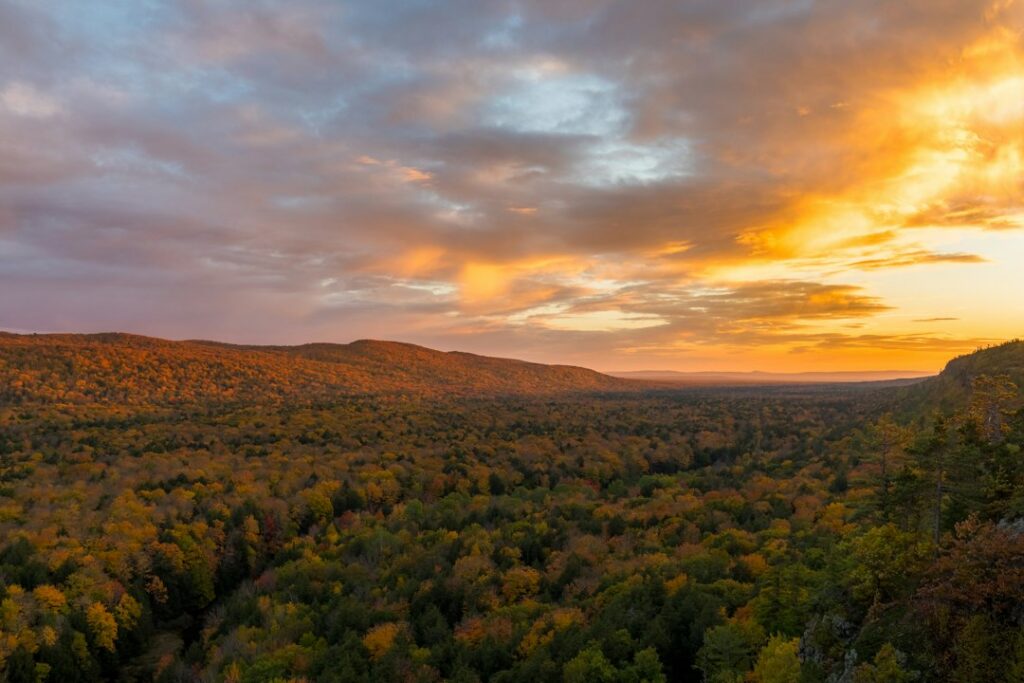
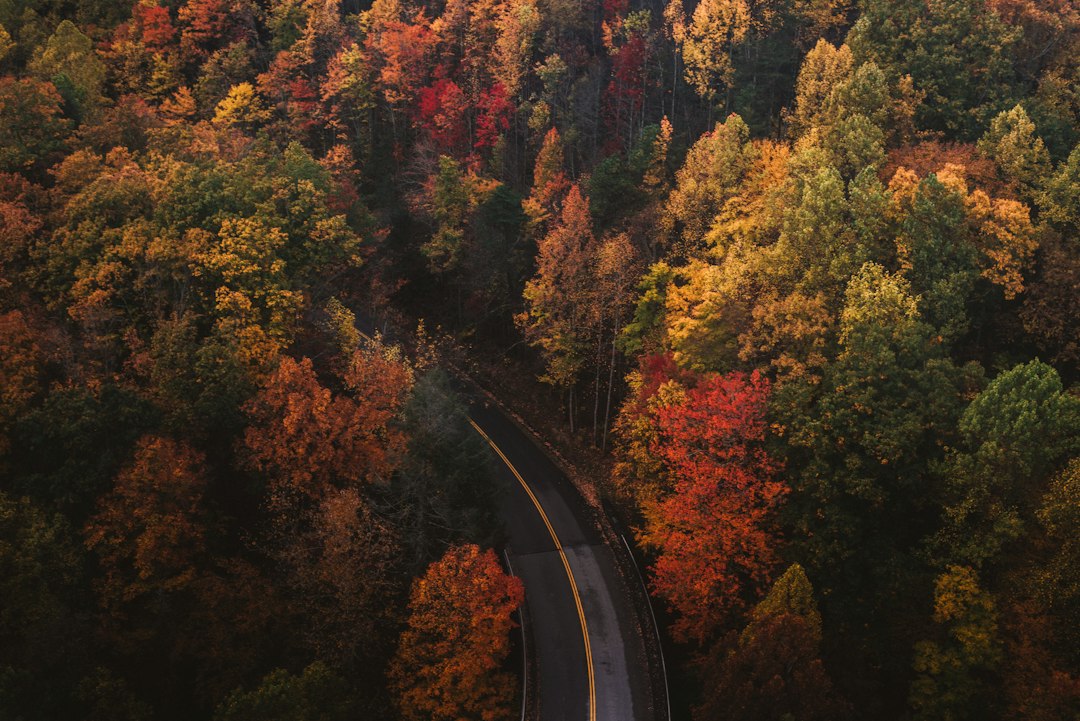
The parking lot at Lake of the Clouds was full by 8:40 on a Saturday morning, and nobody in it seemed to mind waiting. We stood three deep at the rail in light gloves and September breath, watching a valley the size of a small city burn quietly in every direction — maple red, birch gold, the deep patient green of hemlock holding the seams together. A photographer on my crew had been chasing color across four states that week, and she shot maybe forty frames here before putting the camera down. “That’s the one,” she said. “We can go home now.” We stayed three more days. You should too.
Here’s the short version of why: the Porcupine Mountains — the Porkies, to anyone who’s actually been — hold sixty thousand acres of wilderness in Michigan’s western Upper Peninsula, including one of the largest blocks of old-growth hardwood forest left in the Midwest. When that much maple turns at once, the effect isn’t scenery anymore. It’s weather. And for about two weeks every year, usually starting the last week of September, you can stand inside it.
The Two-Week Clock
Timing is the whole game up here, and the Porkies run on their own schedule. Color moves across Michigan from north to south, and the western UP goes first — which means while Detroit is still in shorts, the Big Carp River valley is already peaking. Our trips have landed between September 25 and October 5 more often than not, and that’s still the window I’d book against. I laid out the broader forecasting logic I use in my fall foliage forecast guide, but the local wrinkle matters: Lake Superior sits cold and enormous to the north, and it buys the shoreline a few extra days of green while the ridgelines go early. If you can only pick one weekend, aim early. Color past peak in the Porkies still beats most places at their best, but peak is peak.
One thing I’ll note for the planners: this is not a peak you can dial in from a desk. Reports conflict wildly year to year — I’ve watched “high color” forecasts turn to bare branches in four windy days, and I’ve watched a slow warm stretch hold the maples fire-engine red for two full weeks. Build a flexible window, watch the Michigan DNR’s fall color reports and the local Ontonagon County updates, and accept that a little gambling is part of the fun. The park delivers either way.
The Overlook That Silenced the Car
Lake of the Clouds is the postcard, and I won’t pretend otherwise. You drive M-107 out of Silver City, park at the end, and walk a short paved path to a railing — no summit required, no gear needed, fully worth it. Below you, the Big Carp River bends through a mile-wide bowl of color, the lake itself reflecting whatever the sky is doing. Sunrise is the serious play: the valley fills with low light while mist burns off the water, and the whole bowl looks lit from inside.
Go early or go late, and on a clear weekday you’ll sometimes have the rail to yourself. Midday weekends are another story — tour buses from the copper-country towns roll through, and the lot cycles constantly. My crew’s rule became simple: overlooks at the bookends of the day, trails in the middle. It’s a rhythm that works almost anywhere, but it’s almost mandatory here.
The Escarpment Trail is the upgrade. It runs the ridge above the lake for about four miles of rolling clifftop walking, and the valley stays in view for long stretches in a way the overlook only hints at. You don’t need to do the whole thing — even the first mile and a half from the Lake of the Clouds end delivers the goods, threading through open rock outcrops where the hardwoods fall away below you. Watch your footing on wet bedrock, and give the edges honest distance with kids or dogs.
Summit Peak: The Stairway Above the Sea of Maple
Summit Peak sits at just under 1,950 feet, and the observation tower on top puts you above everything for what feels like half of the UP. The walk up is a gentle half-mile through big hemlocks, and then the tower stairs — a few dozen of them — lift you over the canopy into a view that runs clear across the park’s green-and-gold interior on a fair day. We took up a Thermos food jar loaded with soup on our first climb, and I’ll be honest: eating hot chowder above a burning forest while the wind does the work of a hundred fans is a core memory now. Pack something warm. It earns its space.
This is also where I’d carry optics. The ridges here hold real distance — we’ve watched bald eagles work the river valleys and caught a cow moose with her yearling in a swampy cut a half-mile off, all because someone on the crew packs compact binoculars on every trip now. You don’t need anything serious; light 10x or 12x pocket glasses have paid for themselves in wildlife alone.
Three Waterfalls in Two Miles
The Presque Isle River drains the park’s western flank into Lake Superior, and its final two miles are stacked with named falls — Manabezho, Manido, and Nawadaha — connected by a boardwalk that lets you walk the whole chain without ever really leaving the river. This was the section my crew almost skipped on trip one, and it ended up in everyone’s top three. The dark water slides over shelves of ancient volcanic rock, framed by birch and maple that seem to lean in for their portraits.
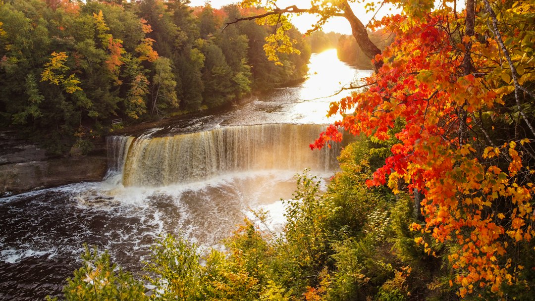
The boardwalk is easy walking, but the steps down to the river mouth get slick with spray, so slow down and keep a hand free. If you want a longer route, the trails upstream toward the falls cross some of the prettiest — and quietest — woods in the park. I’ve written before that Letchworth in October is the East’s great canyon-and-color combination; the Presque Isle is its dense little sibling, water and rock and color compressed into a walk your whole party can finish.
Old Growth, Old Rules
Here’s the thing that makes the Porkies different from every other color trip in the Midwest: these woods were never logged. When you walk the Big Carp River Trail or the loops out of the Government Peak area, you’re moving under trees that were mature before Michigan had cars — grand old sugar maples and hemlocks with real girth, a forest that operates on its own timetables. The color under a canopy like that hits differently. It’s deeper, layered, and when the wind moves through, whole galleries of leaves flash at once.
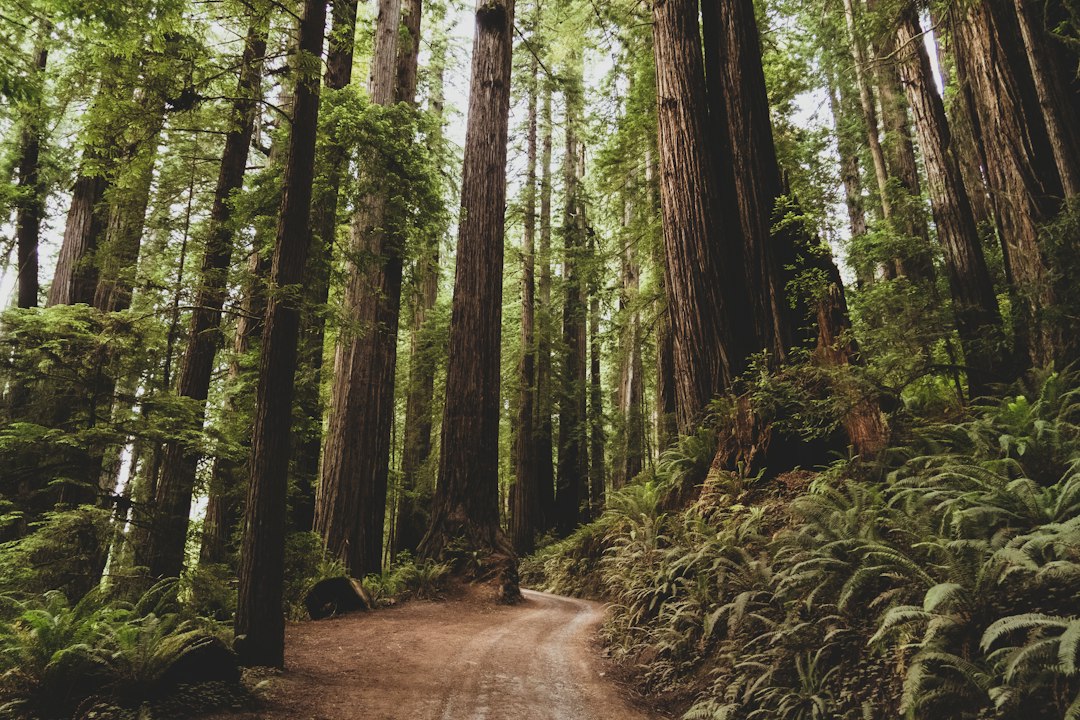
Logistics inside the wilderness are simple but unforgiving. Trails are honestly marked and well-used but rustic — boardwalks and bridges fade to root-and-rock the deeper you go. Water sources are plentiful if you treat them. And the wildlife is real: this is black bear country, active and fattening up in fall, so hang your food or use the poles at the rustic sites rather than learning that lesson the way one member of my crew did, listening to a bear work a neighboring campsite’s cooler at 2 a.m. Nobody was hurt; the cooler retired.
Superior Sets the Mood
Don’t skip the lake. The Parkway runs along the park’s northern edge, and the beaches at Union Bay and the mouth of the Presque Isle give you Lake Superior doing its full impersonation of an ocean — long gravel bars, fat rollers, a horizon that eats ships. In fall the shoreline holds its own late color, and the afternoon light off the water is the best in the park for photos of people, not just landscapes.
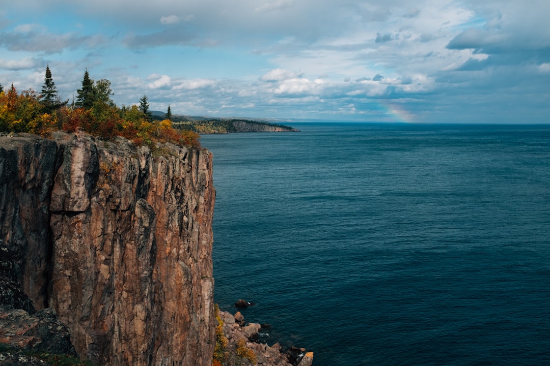
What Superior gives in drama it takes in weather. We’ve had blue-sky 60-degree afternoons up here in early October, and we’ve had 38 and sideways rain an hour later. The fix isn’t to cancel; it’s to pack like the lake is watching. A packable rain shell that stuffs into a daypack pocket has been on every single UP trip we’ve run, and the one person who skipped it in 2024 spent a memorable Presque Isle boardwalk walk performing a wet-dog impression. Daylight shrinks fast this far north in fall, too — dark by 7-ish in early October — so a rechargeable headlamp lives in the top of my pack from the second week of September on. Trailhead-to-trailhead math changes when sunset shows up an hour before you expect it.
Where to Sleep When the Park Is Full
Union Bay Campground is the modern base — electric hookups, hot showers, a short drive from everything — and it books out for peak weekends, sometimes months ahead. The rustic cabins and yurts scattered back into the woods are the move if you want the full experience: wood stove, quiet, and a walk-out-the-door sunrise that the drive-in crowd never sees. They’re coveted exactly when the color is, so reserve through the Michigan DNR system the day your window opens. A Recreation Passport is required for entry — it’s checked, so sort it before the gate.
Town logistics are honest UP stuff: Silver City and Ontonagon cover gas, breakfast, and bait-shop conversation; Bessemer and Wakefield sit inland with more lodging when the park fills. Cell service inside the park is a rumor — download offline maps and tell someone your route, because the wilderness half of that word is not decorative. And if you’re driving up from the south, the run through Michigan’s farm-and-forest middle is better with a plan: our crew’s Pinconning cheese detour has become non-negotiable, and Mackinac after Labor Day makes a clean add-on if you’re crossing the bridge anyway.
The Pack List That Earned Its Spot
Peak week in the Porkies runs cold mornings into mild afternoons, and the packing answer is boring and unbeatable: layers, wool, and hot food. My kit for this trip has stabilized after three falls of edits. A few pairs of merino hiking socks because wet cotton in 45-degree weather is a morale event. A 40-liter daypack that swallows everyone’s shells at once while still carrying light — the trade I’ve settled on after watching over-packers suffer on the Escarpment climbs. A good insulated bottle refilled from the campground tap each morning, because treatable cold water is everywhere in the park but cold-and-cold are different experiences on a ridge.
Cold hands are the silent trip-killer up here, especially on overlook mornings when you’re standing still to watch light do its thing. Rechargeable hand warmers made the permanent list after a Lake of the Clouds sunrise that flirted with frost — small, plane-safe, and they charge off the same pack as the headlamp. Trail food stays simple: grab a big box of individually wrapped trail mix before you leave town and let the passenger seat handle rationing. It’s the only provisioning decision that has never once been regretted on a color trip.
The Honest Bottom Line
The Porcupine Mountains are not a park that performs for you. There’s no lodge with valet parking, no tram to the summit, no app telling you which tree peaks at 9:15. There’s a wilderness big enough to get honestly lost in, a lake that runs the thermostat, ridgelines that burn for two weeks a year, and enough quiet that you can hear individual leaves come down. You bring the timing, the layers, and the flexibility — it brings the other ninety-five percent.
That photographer who put her camera down at the overlook? She was back on the Escarpment the next morning before the sun cleared the ridge, shooting the same valley from a half mile of trail higher. That’s the Porkies in one anecdote. The postcard gets you there; the park keeps you.
- The Sunflower Maze Where You Can Walk Across Illinois in Twenty Minutes

There’s a spot on the north side of Champaign, Illinois, wedged between two interstates, where roughly half a million sunflowers show up for a few weeks each summer and then vanish. No ticket booth. No parking fee. No gift shop funneling you toward the exit. Just a field planted in the shape of something — one year a barn logo, another year a single giant sunflower — with paths mowed through it so you can actually get lost on purpose.
In 2022, the design at Clearview Farm was better than anything a marketing department would dare pitch: the maze was cut in the shape of Illinois itself, and the walkways traced the interstate highways that crisscross the state. You could enter at Chicago, wander down I-57, cut over to I-74, and stand in the middle of a map of the Prairie State with ten-foot stalks of yellow towering over every border. Walking across an entire state takes about twenty minutes when the state is made of sunflowers and you aren’t stuck behind a semi.
A Map of Illinois, Cut in Sunflowers
Clearview Farm sits at 3605 N. Mattis Avenue, close enough to the I-57 and I-74 interchange that you can hear the trucks while you’re standing in the flowers. The maze is the farm’s flagship summer draw, sponsored by The Atkins Group and run with a philosophy that feels almost rebellious in the agritourism world: it’s free. Visitors are invited to donate to the Eastern Illinois Foodbank, and people do, which says something about what happens when you lead with generosity instead of a gate.
The scale is the thing photos fail to convey. In a heavy year, the planting has covered around 25 acres with something approaching 500,000 blooms. The design changes annually — the barn logo, the Illinois map, the giant sunflower, and for 2026 a celebration of America’s 250th birthday — so even locals who come every July are walking a brand-new layout. The farm also tends an Illinois-shaped pollinator garden threaded with “rivers” of native plants, part of a broader regenerative agriculture operation where the sunflowers are as much about soil health and pollinators as they are about foot traffic.
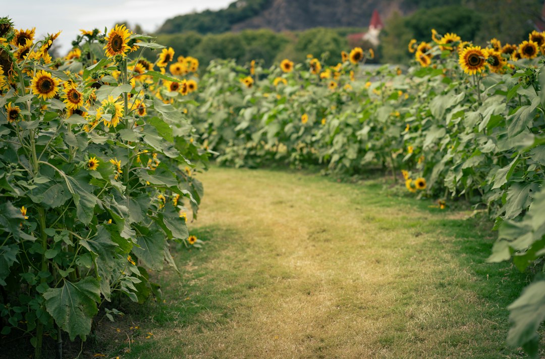
Walking the “interstates” is a strange little joy. The rows close over your head, the compass stops working, and you navigate by landmark — a tall sweet corn stand-in for Springfield, a bend in the path where Route 80 would run. Kids treat it like a puzzle at sprint speed. Adults slow down and do that thing where they stop talking mid-sentence because the light through the petals got them.
The Bloom Window Is Shorter Than You Think
Here’s the catch, and it’s a big one: sunflower season in central Illinois runs roughly mid-July into August, and full bloom lasts maybe two to three weeks depending on heat, rain, and when the farm planted. Some years a field reports early blooms and the whole window shifts. This is not an attraction you can visit “whenever.” It’s an event you chase.
The reliable move is to watch the farm’s social accounts starting in early July and drop everything when the announcement lands. That’s also when each year’s design gets revealed, which has become a small local ritual in its own right — guessing whether the paths will spell something, trace a river system, or redraw the state. Neighboring fields have been known to peak a week apart, so a single well-timed weekend can net you two or three different mazes, each with its own personality: one wide and stroller-friendly, another tight and genuinely disorienting, with walls so tall you lose the sound of the highway a few rows in.
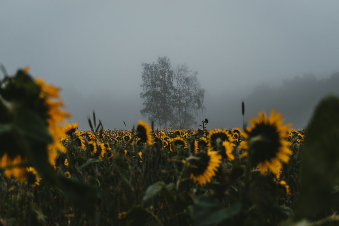
Photographers should plan for morning. Mature sunflowers track the sun all their lives until they’re fully grown, then settle in facing east — so a sunrise visit puts the light behind you and a quarter million faces turned your way. Midday shots flatten out; golden hour here is genuinely golden.
For capturing the full scale, a regular camera struggles — the field wraps around you, and a wide lens only gets a slice. A 360 camera like the Insta360 One X3 on a selfie stick with a built-in tripod is the cheat code: hoist it overhead in the middle of the maze and you get the whole Illinois-shaped layout in one frame, edges glowing.
And when the show ends, it ends fast. The farm lets the heads dry on the stalk until they turn brown and droop like tired umbrella frames, then runs the harvester through. One weekend it’s a golden map; the next it’s a field of nods and seeds. That’s not neglect — it’s the harvest — but it catches visitors who waited for a convenient Saturday and found out the calendar didn’t care about their convenience.
Field Rules, Bees Included
The maze sits on a working regenerative farm, and the etiquette follows from that. A few realities before you go:
- There will be bees. Half a million flowers do not host themselves. Bees that are working a sunflower head are uninterested in you, but if you’re allergic, carry what you need. For everyone else, a spray like Repel 100 handles the mosquitoes and deer flies that also appreciate a July field.
- There is no shade. None. Illinois does not mess around with summer sun, and a reflective wall of yellow petals makes it brighter. A stick sunscreen you can swipe without washing your hands — the Neutrogena Ultra Sheer SPF 60 stick is the road-trip standard — plus a wide-brim UPF hat will save you.
- Bring water. Facilities are seasonal port-a-potties and trash cans, not a visitor center. A cold insulated bottle in the car for after is the difference between a memory and an ordeal.
- The paths are dirt. Unpaved, uneven, occasionally muddy after rain. Closed-toe shoes, especially with kids.
- Don’t pick the flowers. It’s private property, the blooms are a crop, and the foodbank donations that keep the maze free depend on the farm’s goodwill staying intact. Leave it as you found it.
- Park where the signs say. Mattis Avenue parking is not allowed; follow the posted routing during bloom season.

More Gold Within an Hour’s Drive
Clearview is the headliner, but east-central Illinois clusters its sunflower season in a way that rewards a slow loop. In Champaign itself, Prairie Fruits Farm planted its first sunflower maze in 2025 as part of a prairie soil rehabilitation plan — a $10 ticket that buys you blooms and a lesson in what agriculture looks like when it’s rebuilding ground. Down in Clinton, Mariah’s Mums & More opens its sunflower stroll around mid-July, paired with the kind of small-town flower field that photographers quietly hoard.
North in Normal, Rader Family Farms runs Sunflower Days on back-to-back August weekends — a full festival with admission, food, and activities stacked on top of the blooms. If your timing leans late-season, that’s your safest bet: festivals schedule around their flowers, so the flowers are contractually obligated to show up.
Making a Day of It
The maze’s sneaky advantage is geography. Sitting at the I-57/I-74 crossroads puts it within a lazy afternoon’s reach of most of central Illinois — and it makes a genuinely great leg-stretcher on a longer Midwest route. We’ve written before about windshield touring your way toward St. Louis and about why towns like Pinconning, Michigan make the best road-trip detours; a July sunflower stop slots into that same philosophy of letting the map hand you a surprise.
Champaign-Urbana itself earns a few hours — a genuine college-town food scene, an unhurried downtown, and prairie sunsets that put on a show on the drive out. Make the loop properly: maze in the morning light, lunch in town, a slow afternoon somewhere green, then dinner before the drive back west as the fields go amber. If the region gets under your skin, two books capture it properly: Larry Kanfer’s A Prairie State of Mind is the photography volume, and Born in the Illinois Cornfields collects the stories of people who never left. For the full deep dive, the Illinois Loyalty photo book makes a good passenger-seat companion on the way home.
If You Missed the Window
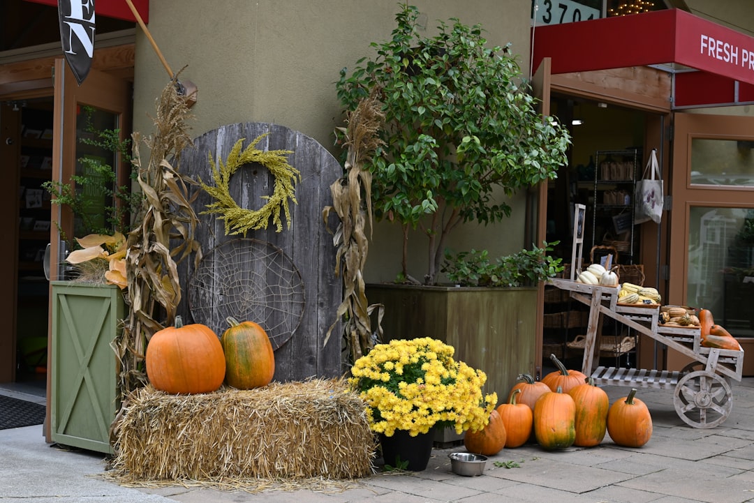
Reading this in September, with the stalks long since browned and the harvester through? You didn’t miss the season — you just arrived at the next one. Central Illinois pivots hard into autumn: the mums and pumpkin stands open along the farm roads around Champaign the way wildflowers do in spring wildflower destinations we’ve chased elsewhere, and the same pollinator spectacle shifts to the monarchs moving through the Midwest on their fall migration — a 3,000-mile journey worth planning around all by itself.
Then put a mid-July reminder on next summer’s calendar: check the farm’s page, watch for the bloom announcement, and go within days, not weeks. Bring the kids, bring a water bottle, bring nothing but your camera’s appetite. Pick up a little something sunflower-themed if you want the day to outlast the season.
Half a million flowers, zero admission, three weeks a year. Some of the best things in the Midwest don’t advertise — they bloom, they feed the bees, they turn brown on schedule, and they wait to see who showed up.