
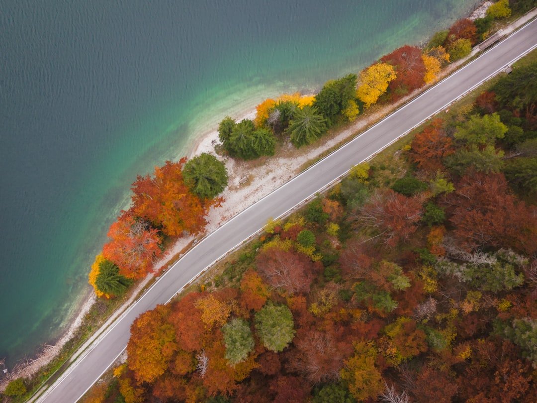
There’s a moment about two hours east of Duluth when Highway 61 narrows, the birch trees crowd close, and Lake Superior opens up on your left like something out of a painting you didn’t know existed. I’d driven a lot of American roads by that point — the Pacific Coast Highway, the Blue Ridge Parkway, the Beartooth — but nothing prepared me for the raw, unpolished beauty of the Lake Superior Circle Tour. It’s roughly 1,300 miles of coastline threading through Minnesota, Wisconsin, Michigan’s Upper Peninsula, and Ontario, and if you haven’t done it yet, summer 2026 is the year to change that.
I first attempted this drive on a whim in late June a few years back, with nothing but a cooler full of sandwiches, a road atlas, and absolutely zero expectations. What I found was a lake so vast it creates its own weather, towns so small they don’t have cell service, and sunsets so dramatic they should come with a warning label. This guide is everything I wish I’d known before setting out.
Why the Lake Superior Circle Tour Belongs on Your Bucket List
Lake Superior is the largest freshwater lake in the world by surface area — over 31,000 square miles of cold, clear water that holds ten percent of the planet’s surface freshwater. But statistics don’t capture what it actually feels like to drive alongside it. The lake dominates everything. It dictates the weather, shapes the culture, and commands your attention mile after mile. Unlike the overcrowded coastal drives of California or the pricey resort towns of the East Coast, the Superior shoreline still feels genuinely wild, and the communities along the way have a resilient, self-reliant character that’s increasingly rare in American travel.
The full circle tour crosses an international border, so you’ll need a valid passport or enhanced driver’s license. Plan for seven to ten days to do it justice, though I’ve met people who stretched it into a month and still didn’t want to leave. The route is well-marked with green “Circle Tour” signs, but I highly recommend picking up a waterproof map case because paper maps are still king in areas where your phone signal vanishes for hours at a stretch.
The Minnesota North Shore: Where the Journey Begins
Most people start in Duluth, and honestly, that’s a fine choice. Duluth has this gritty industrial charm mixed with genuine outdoor culture — you can watch thousand-foot ore boats slide under the Aerial Lift Bridge in the morning and be hiking a waterfall trail by lunchtime. The city’s Canal Park district is touristy but not obnoxiously so, and it’s a good place to stock up on supplies. Grab a large insulated water bottle before you leave town — you’ll thank me when you’re hours from the next gas station.
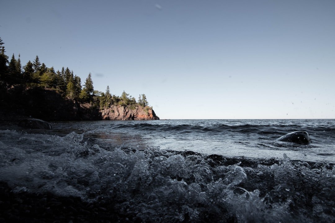
Heading north on Highway 61, the North Shore unfolds in a series of state parks that each deserve at least a couple of hours. Gooseberry Falls is the most popular and most accessible — the cascading waterfalls are viewable from short, easy trails. But my personal favorite is Tettegouche State Park, where the Baptism River drops into the lake through a dramatic gorge. If you’re willing to scramble a bit, Shovel Point offers one of the most stunning lake overlooks on the entire circle tour.
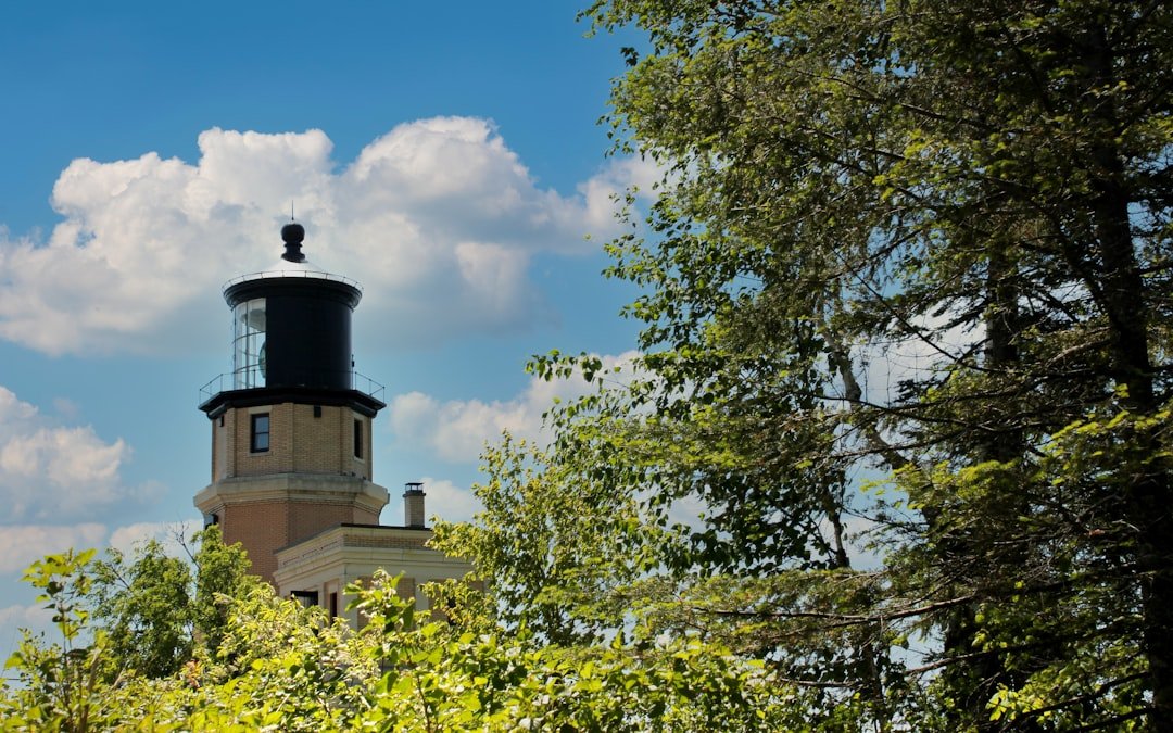
Split Rock Lighthouse is the iconic stop, perched on a 130-foot cliff with views that made me understand why they built a lighthouse there in the first place. The shipwreck history is fascinating — the Edmund Fitzgerald sank about 17 miles north of here, and the museum does an excellent job explaining the lake’s dangerous side. I spent an entire afternoon here and could have stayed longer.
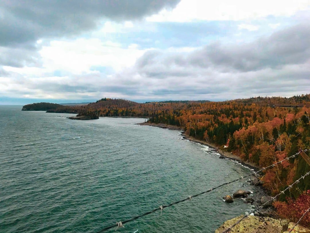
Into Ontario: The Wild and Beautiful North Shore
Crossing into Canada at Grand Portage feels like crossing into another world. The highway narrows, the towns thin out, and the landscape gets dramatically more rugged. Ontario’s Lake Superior Provincial Park is, in my honest opinion, the single most beautiful stretch of the entire circle tour. The Agawa Rock pictographs — ancient Ojibwe paintings on a cliff face at the water’s edge — stopped me in my tracks. You climb down a short, slightly sketchy rock face to reach them, and standing there looking at paintings that could be hundreds of years old while the lake crashes against the rocks below is a genuinely spiritual experience.
The town of Wawa, Ontario is famous for its giant goose statue, which sounds silly until you’ve driven three hours through nothing but forest and suddenly there’s a twenty-foot goose and a Tim Hortons. It’s the perfect place to refuel, both literally and figuratively. The area around Wawa also offers some of the best day hiking on the entire route, with trails leading to secluded waterfalls and dramatic lake overlooks that see surprisingly few visitors.
Pukaskwa National Park, further east, is the hidden gem of the Ontario section. It’s one of the least-visited national parks in Canada, which is mind-boggling given how spectacular it is. The Coastal Hiking Trail is a multi-day backpacking route for serious adventurers, but even a day hike along the suspension bridge and White River trail will give you a taste of what makes this place special.
Michigan’s Upper Peninsula: Shipwrecks and Pasties
Re-entering the United States at Sault Ste. Marie, you’ll find yourself in Michigan’s Upper Peninsula — a place that has its own distinct culture, its own food traditions, and a stubborn independence that I found completely endearing. The Soo Locks are worth an hour of your time; watching massive freighters rise and fall as they pass between Lake Superior and Lake Huron is oddly mesmerizing. If you’re planning other national park adventures, the UP makes an excellent add-on to any Great Lakes itinerary.
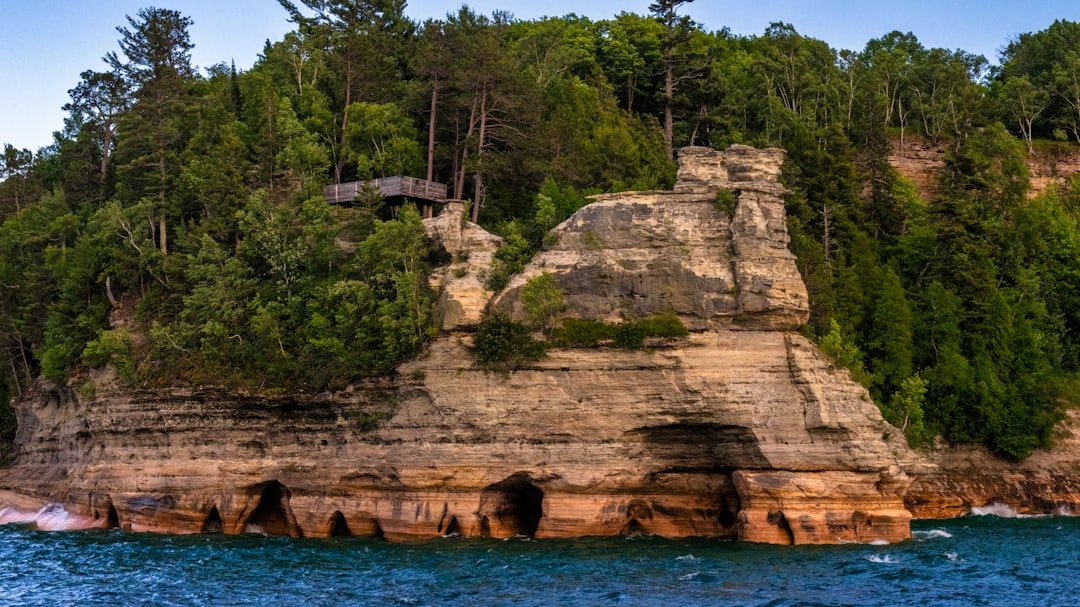
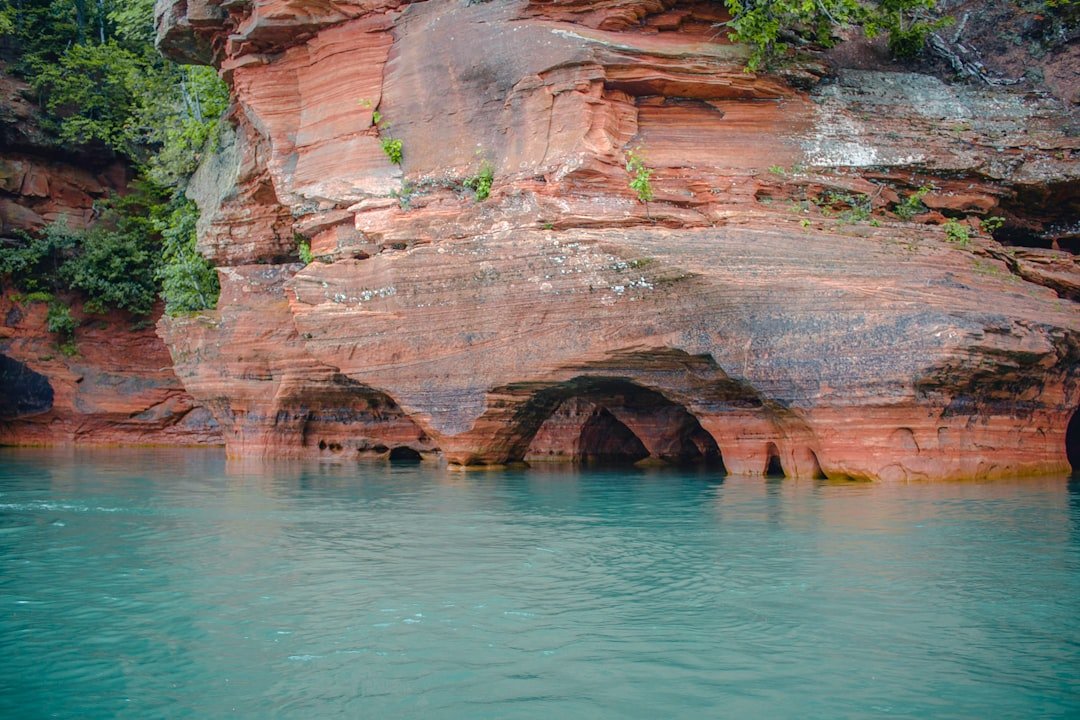
The Pictured Rocks National Lakeshore is the UP’s crown jewel. These colorful sandstone cliffs stretch for 15 miles along the lake, streaked with minerals that paint them in shades of rust, green, blue, and black. You can hike the cliffs via the North Country Trail, but the best way to see them is from the water on a boat tour. Bring a dry bag — the spray off the lake is real and your camera will thank you.
Don’t leave the UP without trying a pasty — the Cornish meat pastry that Copper Country miners adopted as their signature food. Every bakery has its own recipe, and locals have strong opinions about which is best. I ate three different ones in a single day and regretted nothing. Also, if you’re a coffee person, pack your own brewing setup — good coffee is surprisingly hard to find in the smaller UP towns.
The Keweenaw Peninsula and Wisconsin’s South Shore
Before leaving Michigan, take the detour up the Keweenaw Peninsula. It’s an extra day of driving, but it’s worth it for Brockway Mountain Drive alone — a winding road that climbs to a 360-degree panorama of lake, forest, and the distant Porcupine Mountains. The old copper mining towns like Calumet and Houghton have a haunting beauty, with Victorian architecture slowly being reclaimed by the northern wilderness.
Dropping into Wisconsin, the tone shifts again. The Apostle Islands National Lakeshore is the highlight here — 21 islands dotted with sea caves, lighthouses, and some of the clearest water you’ll find anywhere. The sea caves at Meyers Beach are accessible by kayak in summer, and paddling into these sculpted sandstone formations felt like entering a cathedral designed by nature. If you’re planning to kayak, invest in a floating waterproof phone case — you’ll want photos, and Lake Superior is cold enough year-round that dropping your phone means it’s gone forever.
The Wisconsin shoreline is also home to some excellent beach camping opportunities. Wisconsin Point and the Chequamegon-Nicolet National Forest offer quiet, uncrowded spots to pitch a tent and fall asleep to the sound of waves. This stretch feels less dramatic than Minnesota’s North Shore or Ontario’s wilderness, but there’s a peacefulness here that I found restorative after days of cliff-hugging drives.
Planning Your Lake Superior Circle Tour
When to Go
July and August are peak season for good reason — the weather is the most reliable, all attractions are open, and the lake is (relatively) swimmable at beaches along the south shore. September is my personal favorite: fewer crowds, stunning fall colors, and the water is still warm enough from summer to make swimming possible. May and June can be beautiful but unpredictable — I’ve seen snow in May along the Ontario shore.
What to Pack
Layering is non-negotiable. Even in summer, temperatures can swing 30 degrees in a single day, and the lake breeze is always cooler than you expect. A good packable rain jacket is essential — Lake Superior creates its own weather patterns, and clear skies can turn to rain in minutes. Beyond clothing, I’d recommend a solid dashboard phone mount for navigation, a high-capacity power bank for those long stretches without charging options, and a physical road atlas as backup. If you’re planning to camp along the way, make sure your gear handles cold nights.
Budget Tips
The circle tour can be done surprisingly affordably. Camping is widely available and inexpensive, gas is cheaper on the American side, and many of the best experiences — hiking, beachcombing, lighthouse viewing — are free. The biggest expenses will be the Ontario portion (everything costs more in Canadian remote areas) and lodging if you prefer hotels over camping. I spent about $120 a day including gas, food, and camping fees on my most recent trip. Bring a good cooler — grocery stores are few and far between on the Ontario stretch, and restaurant options are limited.
The Drive That Stays With You
I’ve driven a lot of America’s great roads, and the Lake Superior Circle Tour remains the one I think about most often. Maybe it’s the scale of the lake, which never stops feeling enormous no matter how many days you spend beside it. Maybe it’s the communities — practical, welcoming people who’ve built lives in a place where winter shows up in October and doesn’t leave until May. Or maybe it’s the simple fact that this drive hasn’t been polished into a tourist experience. It’s still raw, still wild, still the kind of road trip where you round a corner and see something that makes you pull over and just stare.
If you do one big road trip in 2026, make it this one. Pack your layers, charge your camera, and give yourself permission to take the long way around. The lake will be here, cold and ancient and completely unforgettable.
2 thoughts on “Lake Superior Circle Tour: The Ultimate 2026 Road Trip Guide to the World’s Greatest Lake”