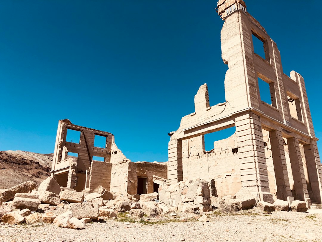
Las Vegas runs out of buildings about forty minutes after you leave it. The slot machines give way to Joshua trees, the radio gives way to static, and then the road tips down into Eldorado Canyon and there it is: Nelson, Nevada, population small enough that the welcome sign seems optimistic. We had loaded the crew van before dawn — my producer insists on dawn departures, something about light — and by nine we were standing in front of a mine headframe older than the state’s gaming license, wondering why it took us this long to build an October trip around towns that don’t exist anymore.
That’s the pitch, really. Five dead towns, one loop, five hundred miles of the emptiest, most photogenic desert in North America. And October, counterintuitively, is the month to do it.
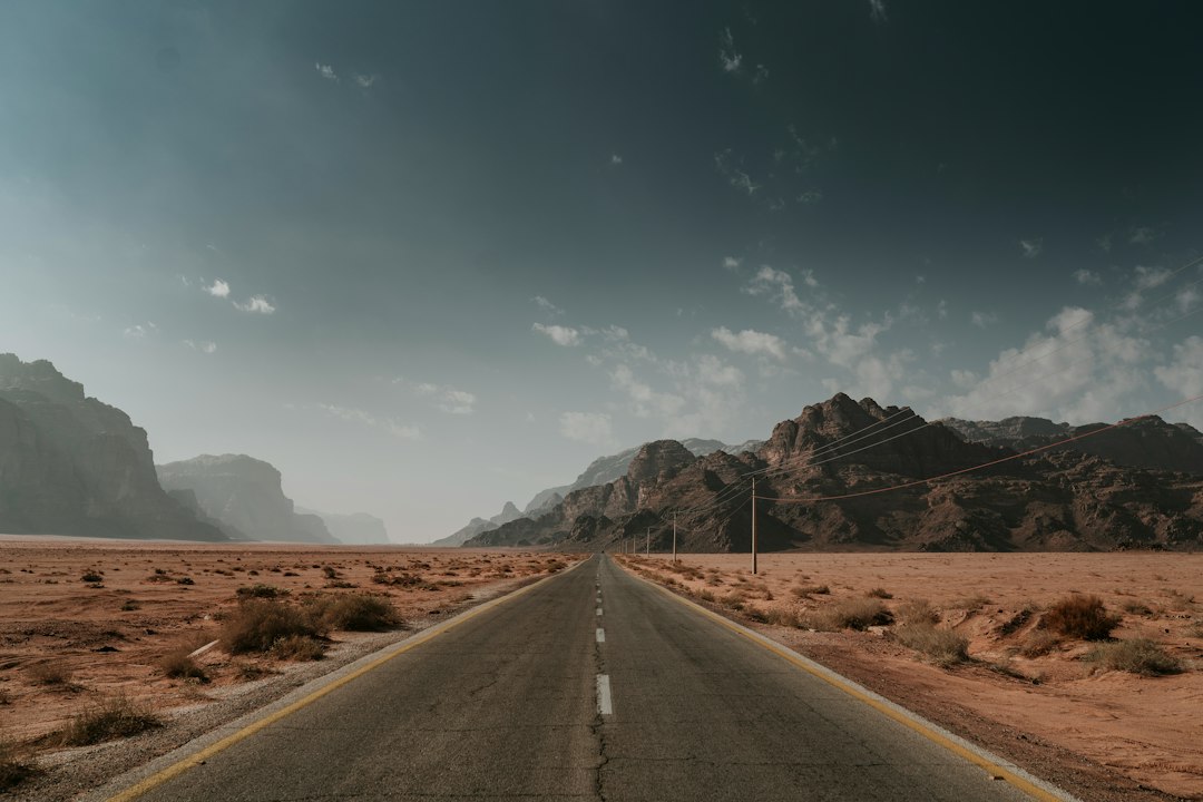
Why October Is the Only Sensible Month
Summer in the Mojave is a punishment detail. The same heat that makes Death Valley genuinely dangerous in July makes everything west of Las Vegas feel like a dare, and the ghost towns scattered across it — most with no shade, no water, and no functioning anything — are flat-out miserable before 6 a.m. and after 6 p.m. from May through September. Come mid-October, the math flips. Daytime highs slide into the seventies and eighties, mornings arrive crisp enough for a hoodie, and suddenly you can spend a full day walking through ruins instead of sprinting between them.
It’s also the season the park itself wakes up — our own rundown of Death Valley’s backwards season explains why October is when that whole region starts humming. The ghost towns on this loop sit in Death Valley’s orbit, so the logic travels: everyone else is chasing fall color in the Rockies, and you’ve got the desert more or less to yourself.
And yes — there’s the atmosphere. A town that emptied out a century ago hits differently when the nights get long and the wind comes down the canyon at dusk. You don’t need to believe in ghosts to feel that Rhyolite is louder at 7 p.m. in October than it has any right to be. If your spooky-season tastes run more coastal, my field-tested Salem plan covers the other end of the country. This one’s for the desert people.
The Route: Five Dead Towns, One Big Loop
Start and end in Las Vegas, because flights are cheap and the airport rental desks open early. From there the loop runs counterclockwise: Nelson first, close enough that you can see it before your coffee kicks in. Then north and west on US-95 to Beatty, the jumping-off point for Rhyolite. Cut through Death Valley on 190, swing south past Panamint Springs, and pick up Ballarat on the edge of the Panamint Valley. Climb out toward Lone Pine and the Owens Valley, where Cerro Gordo waits 8,000 feet up an actual four-wheel-drive road. Finish by dropping south to Calico off I-15 near Barstow, then roll back into Vegas in time for a very normal-person dinner.
Realistically, this is a three-to-four-day trip, not a weekend sprint. The distances aren’t huge, but the towns demand slow looking, and the light in October does that long, golden thing all afternoon. One note on navigation: cell coverage dies fast out here, and the pin drops for half these places are approximate on a good day. We navigate with a paper large-scale road atlas alongside the GPS, and the atlas has won the argument more than once. A UPF 50+ hooded sun shirt earns its keep too — October sun at desert elevation still burns like it’s August.
Nelson, Nevada: The Ghost Town That Gets Photographed for a Living
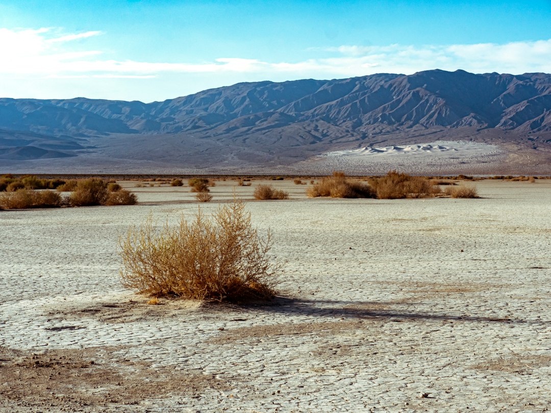
Calling Nelson abandoned is complicated — a handful of people do live out here — but the Eldorado Canyon it anchors is pure boom-and-bust archaeology. The Techatticup Mine was one of the richest gold producers in Nevada history, working veins that prospectors first chased during the Civil War, and the canyon’s kill-and-claim-your-neighbor past is exactly as lawless as the old newspapers make it sound. Today the site runs guided mine tours that walk you a quarter-mile into the hillside, past timbers that have been holding up their end of the bargain since the 1800s.
The exterior is the draw for most visitors: rusted trucks, peeling buildings, and equipment arranged with a set-dresser’s eye. And it literally is a set — Hollywood has shot everything from music videos to westerns in this canyon, which explains why the junk looks so perfectly placed. It’s about as ghost-town-lite as this loop gets, which makes it a good warm-up. Bring a thermos of something hot; mine interiors hold a damp chill even when the canyon above is baking. We field-tested our 40-ounce vacuum bottle here and the coffee survived three towns.
Rhyolite: The Town That Rose and Fell in Seven Years
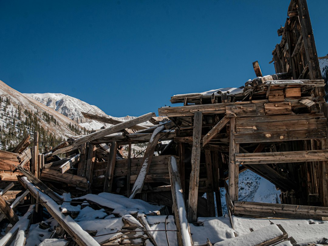
Of all the corpse towns in the American West, Rhyolite is the one that messes with your sense of time. Prospectors struck gold in 1904, and within three years this spot had a three-story bank, an opera house, a stock exchange, and a population that swelled toward ten thousand. By 1911 the mines were failing, and by 1920 the census taker could have counted the remaining residents on one hand. The boom lasted roughly the length of a car loan.
What’s left is the good kind of haunting. The Cook Bank building stands as a hollow façade of imported stone, absurdly grand for a town that died before Prohibition. The old train depot still broods at the edge of town. And then there’s the Tom Kelly bottle house — a three-room home built in 1906 from something like fifty thousand discarded medicine and whiskey bottles, because lumber cost more than thirst. It glows like a lamp when the afternoon sun hits it. Everything here is free, open dawn to dusk, and managed by the BLM, which means raw ground, honest ruins, and the on-you etiquette of not touching the walls. They’re softer than they look.
Ballarat and the Panamints: Where the Pavement Gives Up
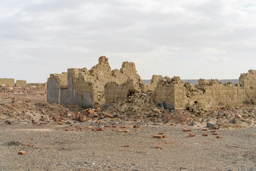
West of Death Valley, the road descends into the Panamint Valley, and the map goes quiet. Ballarat was born in 1897 as a supply camp for the mines scratching at the Panamint Range above it — brutal, waterless, gold-bearing country that ate mules and men with equal appetite. When the mines coughed out their last ore, Ballarat simply stopped. What remains are adobe walls melting back into the dirt, a scattering of rusted machinery, and a general store that serves the occasional traveler, cold drinks, and more ghost stories per square foot than any building in Nevada.
This is the stretch where the trip’s tone shifts. Nelson and Rhyolite are managed, interpreted, safe. Ballarat feels found. The road up Surprise Canyon toward the old mine sites is genuinely rough — high clearance only, and even then think twice — so most visitors stay near the valley floor, photographing the wrecked vehicles that desert artists keep arranging into new shapes. Wind picks up grit off the dry lake bed, so we run a cooling neck gaiter pulled over the face; after a day here you’ll understand why the desert classic look is a bandana.

Cerro Gordo: The Silver Town You Can Sleep In
From the valley floor the loop climbs into the Inyo Mountains above Owens Valley, and this is where the trip earns its frontier cred. Cerro Gordo — “fat hill” — poured out silver and lead from the late 1860s and helped bankroll Los Angeles into existence; the ingots moved down to the coast by mule train for decades. The mines closed for good in the 1930s, and the town sat frozen above 8,000 feet until 2018, when a young outsider bought the whole thing — buildings, tunnels, and all — and moved in alone to bring it back.
That’s not a movie pitch; that’s the actual recent history, and it’s why Cerro Gordo is now bookable. The property runs tours, and a small number of overnight guests sleep in restored buildings that were saloons and boarding houses when Nevada was still a territory. You have to reserve ahead, and the road up is a serious unpisted climb, but standing on the hotel porch at dusk, looking eleven thousand feet down at the Owens Valley while the light dies, is the single best moment on this loop. About two dozen original structures still stand, stabilized but honest — bring a compact LED flashlight, because interiors get dark and floorboards get opinions.
Calico: The Ghost Town That Refuses to Die
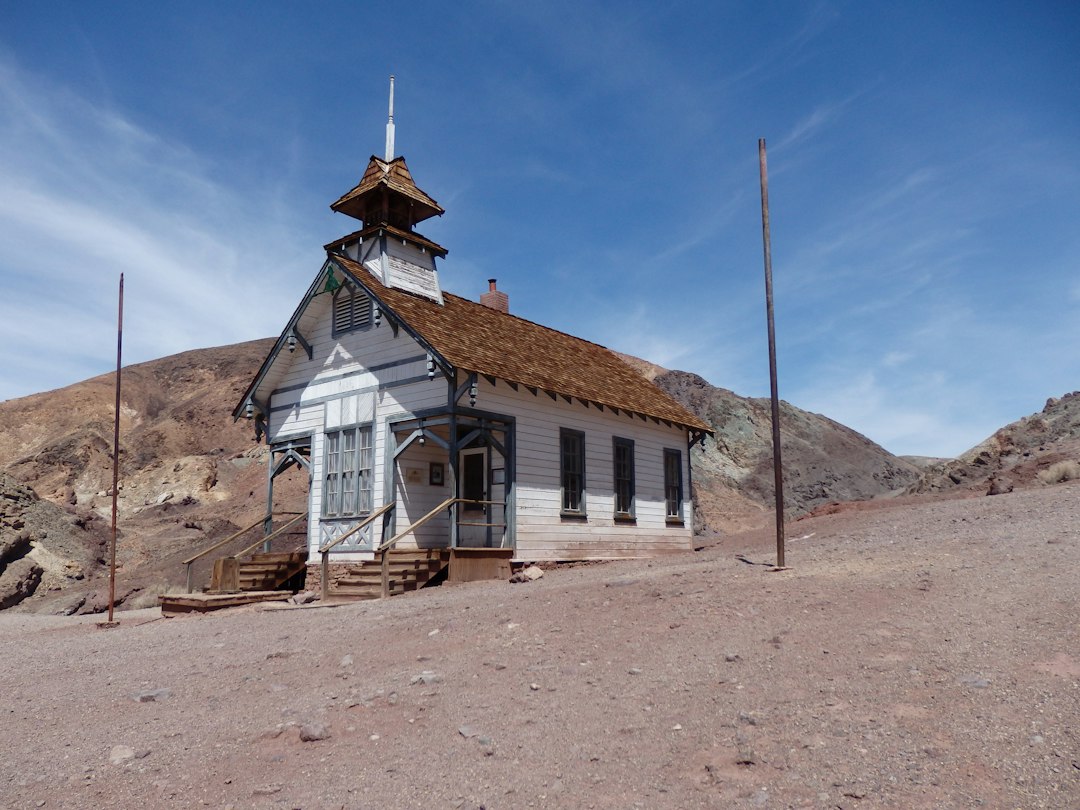
The loop’s final stop is its strangest contradiction. Calico threw off millions in silver starting in 1881, went bust by the mid-1890s, and sat decaying until the 1950s, when Walter Knott — yes, of Knott’s Berry Farm — bought the whole townsite and restored it as a labor of love, later handing it to San Bernardino County as a regional park. So what you get today is a ghost town in excellent health: rebuilt storefronts, a working narrow-gauge train, mine tours into genuinely old tunnels, and a main street that photographed half your grandparents’ Route 66 road trip.
Purists sniff at Calico’s gift shops. I think they’re misreading the assignment. The restoration is faithful enough that kids grasp what a mining town was, the surrounding canyon hikes deliver real solitude within ten minutes of the parking lot, and October weekends lean hard into the season with themed events and decorations that would make a haunted house blush. It’s the accessible end of a trip that otherwise demands fuel math and gumption. Speaking of the Mother Road — Barstow sits right on old Route 66, and our centennial guide to the Mother Road covers how to stitch a stretch of it onto the drive home.
After Dark in a Dead Town
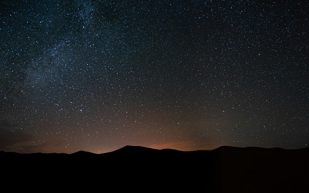
Here’s the part nobody warns you about: the ghosts are on the night shift, but so is the sky. Death Valley country holds International Dark Sky status, and the little towns orbiting it inherit that ceiling. On our Rhyolite night we killed the headlamps, let our eyes adjust for ten minutes, and watched the Milky Way sharpen over the Cook Bank ruins until it looked less like astronomy and more like weather. My photographer stayed up until two shooting star trails behind the bottle house and swears it was the best night of her year.
Practical dark-land advice: carry a rechargeable headlamp with a red-light mode — full beam obliterates everyone’s night vision, and red keeps the group functional while preserving the magic. Watch your footing near ruins; old town sites grow nails, glass, and open shafts the way forests grow mushrooms. And let someone know your plan, always, because “just past the ghost town” is not a useful coordinate for a search party.
What the Crew Packs for Empty Country
Five hundred desert miles with long no-services gaps is a packing problem, and we’ve dialed the list over several of these runs. The non-negotiables are the boring ones. A satellite communicator — we run a Garmin inReach Mini 2 — because Cerro Gordo’s road and the Panamint backroads have exactly zero bars when things go sideways. A cordless portable tire inflator, because desert roads eat tires politely and you won’t notice until the steering feels philosophical. And a compact waterproof first-aid kit that lives in the driver’s door, not the bottom of a duffel.
The fun one is the drone. A sub-250-gram flyer like the DJI Mini 4K is small enough to forget you’re carrying it and cheap enough that a gust over the Panamints won’t ruin your year, and ghost towns from above are a religious experience — the street grids of Rhyolite read like a map of ambition, and Cerro Gordo’s switchbacks make the road itself the story. Check current rules before you fly; most of this land is BLM or private, and Cerro Gordo in particular means asking permission first. We did, and the caretakers were as generous with the airspace as they were with the history.
Fuel, Water, and the Unwritten Rules
The logistics are simple but unforgiving. Fuel up in Pahrump, Beatty, Stovepipe Wells or Panamint Springs, Lone Pine, and Barstow — I’d treat a half tank as empty, because pumps in the valleys close early and stations between them don’t exist. Carry more water than seems reasonable; the rule of a gallon per person per day is a floor, not a suggestion, and October warmth seduces people into underestimating it. Build every day around the light: ruins and dunes before ten or after four, museums and mine tours at noon.
And the unwritten rules, written down. Take nothing — not a bottle shard from the bottle house, not a square nail from Ballarat, not “just one” rusted thing. Stay on established routes, because tire tracks in desert crust outlive most of the buildings you came to see. Leave gates as you found them. These towns died once already; the only reason they still exist is that a hundred years of visitors mostly kept their hands in their pockets. Be part of that tradition, and this loop will still be here, spooky and perfect, every October for the next century.
That’s the whole pitch. Pack the hoodie and the headlamp, charge the drone and the satellite messenger, and go stand in a town that time walked past. Gold built these places in a hurry and abandoned them faster, and the desert has been keeping them ever since. October is when they’re at their best — cool, empty, and quietly spectacular. Just don’t be the person who takes the square nail home.
1 thought on “The Towns the Gold Left Behind: One October Loop Through the Mojave’s Best Ghost Towns”