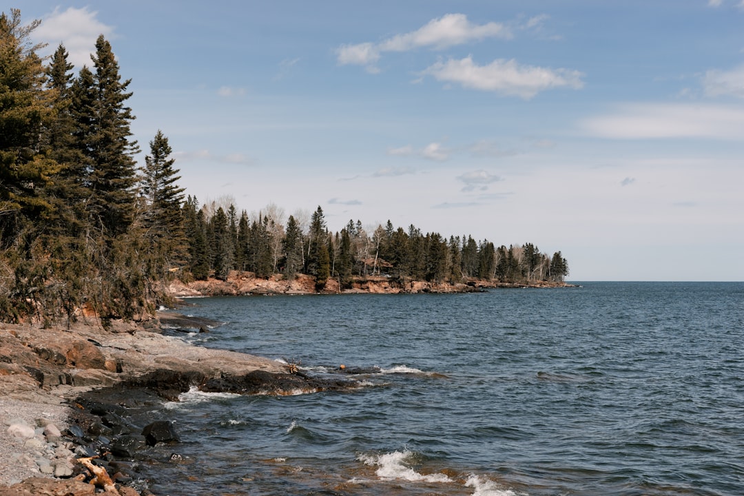
There’s a moment on Minnesota’s Highway 61 — somewhere past Two Harbors, when the birch trees thin out and the lake opens up on your left like an inland sea — where you stop checking your phone. Not because you lost signal (though you will). Because there’s nothing on a screen that competes with 31,000 square miles of cold, dark water stretching to a horizon that doesn’t look like a lake at all. It looks like an ocean that forgot where it was supposed to be.
I’ve driven a lot of scenic roads across North America. The Blue Ridge, the Pacific Coast Highway, the Million Dollar Highway. Each one earns its reputation. But the 154-mile stretch of Minnesota’s North Shore — from Duluth to the Canadian border at Grand Portage — hits different. Maybe because Lake Superior is less a lake and more a geological personality. It creates its own weather, swallows ships whole, and refuses to warm up past fifty-five degrees even in August. The communities along its edge are small, stubborn, and built around the understanding that the lake is in charge.
My team and I spent five days covering every mile of this corridor during peak summer — blueberries ripe, waterfalls thundering, and the angle of light hitting basalt cliffs in a way that makes you understand why this stretch birthed an entire school of painting. What follows is everything I learned, the stops that matter, the gear that earned its place in my pack, and the mistakes I made so you don’t have to.
Duluth: Where the Shore Begins
Most travelers blow through Duluth on their way north. That’s a mistake. This city of 90,000 sits on a hillside overlooking the westernmost tip of Lake Superior, and its harbor is one of the busiest freshwater ports in the world. I started at Canal Park, watching a thousand-foot ore carrier slide through the Aerial Lift Bridge with the slow, deliberate gravity of something that weighs more than a small neighborhood. The bridge rises, the ship passes, and everyone watching goes quiet for a minute. It’s involuntary.
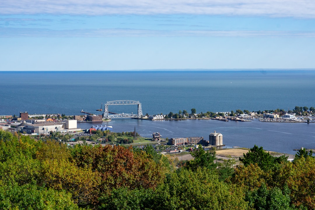
Spend a morning here before driving north. Grab coffee at Alakef Coffee Roasters, walk the Lakewalk (a paved trail that hugs the shoreline for miles), and if you have time, the Lake Superior Maritime Visitor Center is free and genuinely fascinating — the shipwreck exhibits alone are worth thirty minutes of your time.
Before leaving Duluth, I made sure my portable charger was topped off. The INIU 45W pack I carry kept my phone alive through three days of photo-heavy hiking and GPS navigation, and it’s small enough to forget it’s in your pocket. Cell service gets patchy north of Two Harbors — not nonexistent, but unreliable enough that offline maps and a charged battery become essential, not optional.
Highway 61: The Drive Itself
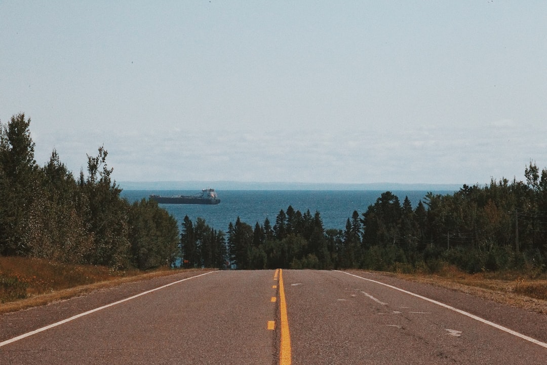
Let me be clear about something: this is not a drive you power through. The speed limit hovers around 55 mph, but you’ll rarely hit it. Not because of traffic — August is busy but not gridlocked — but because every mile reveals another overlook, another wayside, another trailhead that looks too good to skip. My rule was simple: if the car ahead of me pulled over, I pulled over. They’d seen something I hadn’t yet.
The road was built for the kind of travel that rewards curiosity over efficiency. Minnesota’s Department of Transportation has placed numbered wayside rests roughly every five to ten miles, each one offering a different angle on the lake. Some have short trails. Some have historic markers. A few have nothing but a bench and a view so wide it makes your chest feel tight. Stop at as many as your schedule allows. The drive isn’t the commute — it’s the attraction.
I kept a compact road trip cooler stocked with sandwiches and drinks from a Duluth grocery store. The RTIC 16-quart sat perfectly behind the passenger seat and held ice for two full days in August heat. When you’re three hours from the nearest restaurant and the next trailhead is calling, cold food and cold drinks aren’t a luxury — they’re the difference between a good day and a great one.
Gooseberry Falls: The Gateway State Park
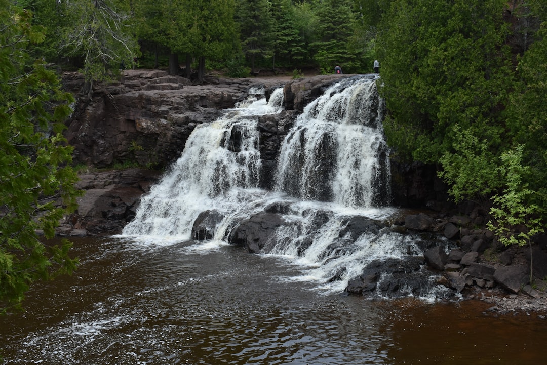
Twenty-six miles north of Duluth, the Gooseberry River drops over a series of ancient lava flows before emptying into Lake Superior. The result is Gooseberry Falls State Park — one of the most visited parks in Minnesota and the unofficial gateway to the North Shore. I arrived at 8 AM on a Tuesday and had the Middle Falls viewing platform nearly to myself. By 10 AM, the parking lot was full and families were circling for spots.
The falls are impressive — especially in spring when snowmelt swells the river — but August offers something different: potholes carved into basalt by thousands of years of swirling water, accessible via a short loop trail that’s easy enough for kids and rewarding enough for serious photographers. My team spent two hours here and could have stayed longer.
The trail system at Gooseberry connects to the Superior Hiking Trail, a 310-mile footpath that runs from Duluth to the Canadian border along the ridgeline. You don’t have to commit to a thru-hike to experience it — park headquarters has maps for segment hikes ranging from one to eight miles. Wear real boots. The rocky terrain eats sandals for breakfast, and the mosquitos in the wooded sections are not joking around. I packed OFF! Deep Woods insect repellent and re-applied liberously. Without it, the wooded sections near the river would have been unbearable.
Split Rock Lighthouse: The Postcard Stop
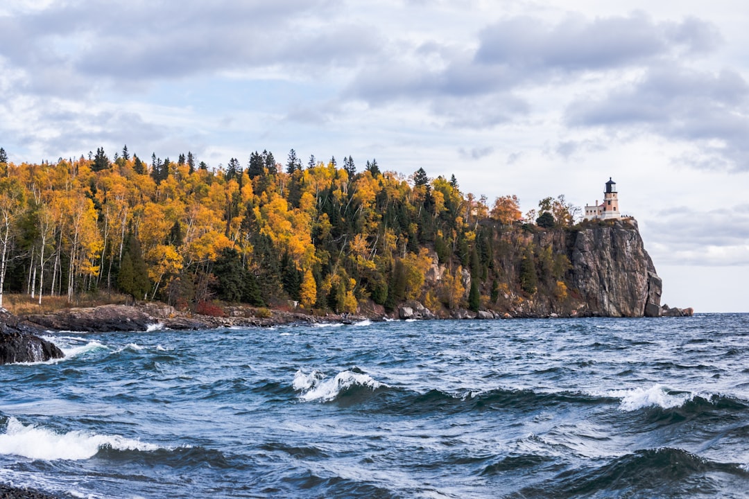
If you’ve seen one photograph of Minnesota’s North Shore, it’s probably Split Rock Lighthouse. Perched on a 130-foot cliff above the lake, this 1910 lighthouse was built after a brutal 1905 storm sank three ships in a single night. The story alone is worth the admission — but the view from the cliffside walkway, looking down at water so clear you can see the rock formations thirty feet below the surface, is the real payoff.
I recommend timing your visit for late afternoon. The western light hits the lighthouse’s white tower and turns the lake into a sheet of hammered copper. The historic buildings are well-preserved, and the visitor center does an excellent job explaining why Lake Superior was — and remains — one of the most dangerous bodies of water for commercial shipping in North America.
This is also one of the best spots on the shore for wildlife viewing with compact binoculars. I watched a bald eagle work the thermals above the cliff for twenty minutes while my team explored the fog signal building. The Occer 12x25s I keep in my daypack are lightweight enough to forget you’re carrying them, and the clarity at this price point is genuinely surprising. Peregrine falcons nest in the cliffs here, and during fall migration, the raptor watching is world-class.
The Sawtooth Mountains: Hiking Above the Lake
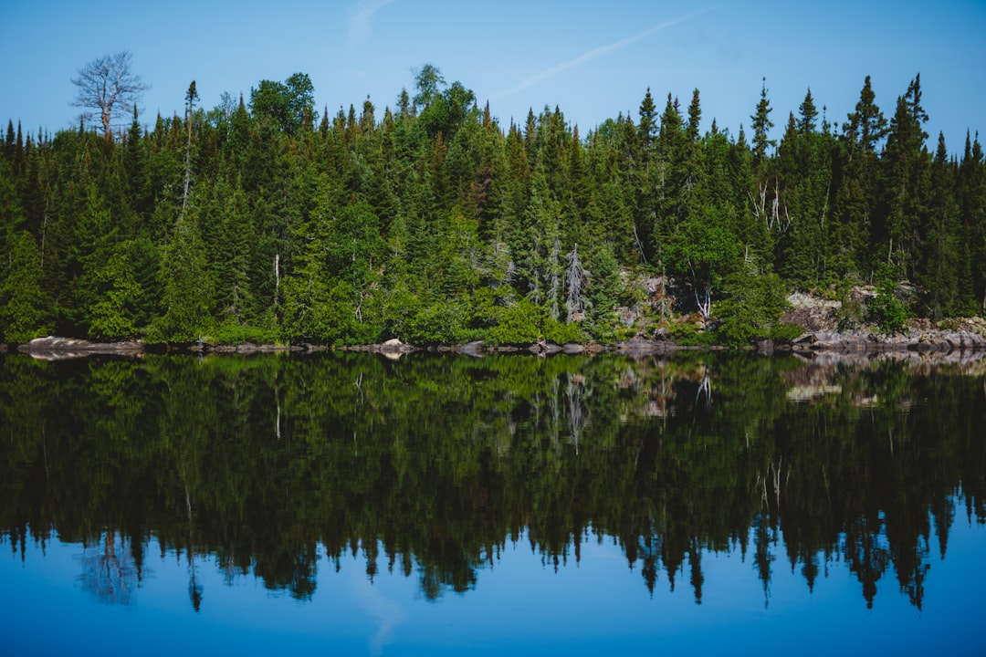
The North Shore isn’t flat. The Sawtooth Mountains — ancient volcanic ridges that rise sharply from the shoreline — provide some of the most rewarding day hiking in the Midwest. These aren’t Rocky Mountain peaks (the highest, Eagle Mountain, tops out at 2,301 feet), but what they lack in altitude they make up for in attitude. Trails are rocky, root-filled, and steep enough to get your heart rate into the zone where conversation stops.
I hiked the Oberg Mountain loop — a 2.3-mile trail that climbs through dense maple and birch forest before breaking out onto exposed ridgeline with panoramic views of the lake. Even in August, when haze softens the horizon, the view stretches fifty miles in every direction. In fall, when the maples turn, this trail is the kind of beautiful that makes people book flights from across the country.
Good footwear is non-negotiable here. The basalt rocks are sharp, and the trail surfaces are unforgiving. I wore my Columbia Transverse waterproof hiking boots for every North Shore hike and never once worried about ankle support or wet feet. My partner, who struggles with narrower men’s lasts, found the Merrell Moab 3 Mid Waterproof in women’s sizing to be the most comfortable option after trying four different brands. Creek crossings, morning dew on trail grass, and the occasional scramble over wet rock — none of it got through.
Temperance River and the Hidden Cascades
Here’s where the North Shore rewards travelers who go beyond the highlight reel. Temperance River State Park — named for the river’s lack of a “mouth” bar (it flows directly into the lake through a narrow gorge, depositing no sediment) — contains some of the most dramatic geology on the shore. The river has carved a deep gorge through basalt and rhyolite, creating hidden waterfalls, swirling potholes, and chutes where the water moves with enough force to vibrate the rock under your feet.
The hiking trail follows the river inland, crossing it twice via footbridges before climbing to a ridge overlooking the lake. I spent an afternoon here and saw maybe a dozen other people. This is the North Shore’s secret — for every Gooseberry Falls crowded with bus tours, there’s a Temperance River that’s equally spectacular and half as visited. If you’re looking for the experience I describe in our guide to state parks that outshine their national neighbors, this is exactly that energy.
Bring a compact first aid kit on these trails. The 150-piece kit I carry weighs less than a pound and clips to my pack’s hip belt. I didn’t need it on this trip — but last summer, a slip on wet rock in Michigan’s Upper Peninsula turned a casual day hike into a situation that required bandaging and tape. The North Shore’s trails are well-maintained, but volcanic rock doesn’t care about your plans.
Grand Marais: The Town That Steals Hearts
Population 1,300. One stoplight. A harbor that looks like it was designed by someone who understood exactly how much charm a small town can carry without tipping into kitsch. Grand Marais is the kind of place where you arrive for lunch and somehow end up staying three days. I’m not exaggerating — my team had to adjust our entire itinerary because none of us wanted to leave.
Start at the Angry Trout Cafe, a converted fish house on the harbor that serves lake trout smoked over local wood. Walk out to the Artists Point, a narrow strip of land between the harbor and the open lake where the founders of the Grand Marais Art Colony set up their easels in 1947. The tradition stuck — this town takes art seriously. Galleries line the main street, and the quality is far beyond what you’d expect in a town this size.
World’s Best Donuts is not hyperbole. It is a statement of fact, verified by me, confirmed by my team, and corroborated by the line of people stretching out the door at 7 AM. Get there early. Get the maple glazed. Thank me later.
The Boundary Waters: Wilderness on Another Scale
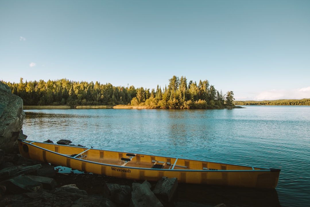
North of Grand Marais, the road enters its final stretch — thirty miles of increasingly wild shoreline leading to Grand Portage and the Canadian border. This is the edge of the Boundary Waters Canoe Area Wilderness, a 1.1-million-acre roadless area of lakes, rivers, and boreal forest that is among the most pristine wilderness areas in the lower forty-eight.
You don’t need a canoe permit to experience the Boundary Waters atmosphere. The Gunflint Trail — a 57-mile paved road that heads north from Grand Marais into the boreal forest — gives you a taste without the commitment. I drove it on my last afternoon, stopping at the overlooks where you can see across a sea of green treetops to the dim blue hump of the Sawtooth Mountains to the east. The air smells different up here — pine, cold soil, and something almost mineral that I associate with places that have been wild for a very long time.
This is moose country. I didn’t see one — they’re most active at dawn and dusk, and I was there at midday — but the evidence was everywhere: tracks in the mud at trailheads, warning signs on the highway, and the slightly anxious energy of other hikers who’d arrived earlier. Black bears are also present. Make noise on trails, carry the first aid kit I mentioned, and if you’re camping, store food properly.
Weather: The Lake Decides
Here’s what nobody tells you about Lake Superior in August: it can be 80 degrees in Duluth and 55 degrees in Grand Marais on the same day. The lake generates its own fog, its own wind patterns, and its own microclimates along the shore. I packed for summer and nearly froze on my first morning in Tofte, where fog rolled in off the lake and dropped the temperature thirty degrees in twenty minutes.
A packable rain jacket — I carry Columbia’s Watertight II — was the single most important piece of gear on this trip. It stuffs into its own pocket, weighs almost nothing, and handled everything from cold wind on exposed ridgelines to a surprise thunderstorm at Cascade River State Park. If there’s one item I’d tell every North Shore traveler to bring regardless of season, it’s a waterproof shell.
The lake also affects visibility. Fog can reduce driving conditions to near-zero with no warning, particularly in the morning hours. Check conditions before heading out, drive slowly, and use headlights. The fog usually burns off by mid-morning, but it can linger for days if the temperature differential between the water and air is right.
What to Eat: Beyond the Tourist Menus
Skip the chain restaurants in Duluth. The North Shore’s food culture is built on three things: fish, foraging, and Scandinavian heritage. Here’s what earned a place in my notes:
- Lake trout and whitefish — Available at almost every restaurant along the shore. The best I had was at the Angry Trout in Grand Marais, but Lockport Marketplace in Two Harbors does an outstanding smoked whitefish dip.
- Wild rice — Minnesota’s state grain, harvested from regional lakes. Look for it in soups, hot dishes, and as a side. It’s nutty, chewy, and nothing like the cultivated version.
- Pasties — A Cornish miner’s hand-pie that became a regional staple. Beth’s Pies in Duluth makes an excellent one, and you’ll find variations at bakeries all the way up the shore.
- Maple syrup and wild berry products — Birch syrup, thimbleberry jam, and maple candy from roadside stands. Buy from the producer, not the gift shop.
For road trip snacking, I pre-packed a snackle box with divided compartments — cheese, crackers, nuts, dried fruit, and the best beef jerky I could find. When you’re six hours from a sit-down restaurant and the next scenic overlook is too beautiful to leave, having real food ready to eat is a quality-of-life upgrade that pays for itself on day one.
Planning Your Trip: Timing and Logistics
August is ideal — wildflowers are at peak, the lake is as warm as it gets (which still means wetsuit territory), and the bug situation is manageable compared to June. But the North Shore shines year-round. September brings fall color that rivals New England, winter transforms the shoreline into an Arctic landscape of sea smoke and ice caves, and May offers waterfall viewing at maximum volume from snowmelt.
If you’re planning an August trip, here’s my advice:
- Book lodging early. The best places — particularly the historic lodges and lakefront cabins — fill up months in advance.
- Buy a Minnesota State Parks pass. One pass covers all eight state parks along the shore. It pays for itself by the third park.
- Download offline maps. Cell service is reliable in towns but spotty between them.
- Layer your clothing. The temperature range on any given day can be forty degrees.
- Plan for slow travel. This isn’t a highway you rush. Budget a full day for the Duluth-to-Grand-Marais stretch minimum.
For lodging, I recommend splitting your stay between a base near Two Harbors (central location for the southern parks) and Grand Marais (walkable town, great restaurants, access to the upper shore). This mirrors the approach I describe in why late August is America’s best-kept travel secret — strategic timing plus strategic location equals an experience that feels uncrowded even during peak season.
Gear That Earned Its Spot
Five days on the North Shore taught me which gear matters and which is dead weight. Here’s the short list:
Footwear first. The trails are rocky, rooty, and often wet. Waterproof hiking boots are not optional — they’re the difference between enjoying the hike and enduring it. I tested both men’s Columbia Transverse and women’s Merrell Moab 3 options across eight different trails, and both performed flawlessly.
Stay dry. A quality rain jacket like the Columbia Watertight II handles everything the lake throws at you — fog, spray, thunderstorms, cold wind. It packs into nothing and costs less than a dinner in Duluth.
Keep devices alive. With patchy cell service draining batteries faster than normal, the INIU 45W power bank was a daily essential. Three full phone charges from a single unit, and it charges itself in under two hours.
Eat well on the trail. The RTIC road trip cooler kept food cold for two days in August heat. For organized snacking, the RicheMake snackle box with eight compartments and a carrying handle became our most-used trail accessory.
See more. Compact binoculars changed the way I experienced the wildlife on this trip — from bald eagles to possible moose sightings to distant ore ships on the lake.
Be prepared. The 150-piece mini first aid kit stays clipped to my pack on every hike. Lightweight, waterproof case, comprehensive contents.
Stay comfortable on the drive. Five days of driving deserves a good travel neck pillow. The BCOZZY’s double-support design saved my neck during the long haul between Duluth and Grand Portage.
The Verdict
I’ve traveled to a lot of places that were described to me as “hidden gems.” Most aren’t. The North Shore is different — it’s accessible enough that anyone with a car and a long weekend can experience it, yet wild enough that you can stand on a cliff above Lake Superior and feel genuinely small. The lake is the largest freshwater body on Earth by surface area, and standing on its shore, you understand why the Ojibwe called it Gichi-gami — the great sea.
The drive from Duluth to Grand Portage takes about three hours without stops. With stops — which is the only way to do it — it’s a full day, minimum. I recommend two or three. The pace here is slower. The coffee is better. The lake is always there, on your left, cold and ancient and indifferent to your schedule.
Go in August if you can. But honestly? Go whenever you can. The North Shore doesn’t have a bad season. It just has different ways of being unforgettable.