Three summers in a row, I drove Highway 1 through Big Sur and saw absolutely nothing. That’s not an exaggeration. The marine layer in July sits on that coast like a wet blanket someone forgot to take off — you get 400 feet of visibility, a gray Bixby Bridge, and a souvenir shop’s worth of disappointment. My last August attempt, one of my researchers counted eleven consecutive pullouts where we stepped out of the van into what amounted to a cold cloud.
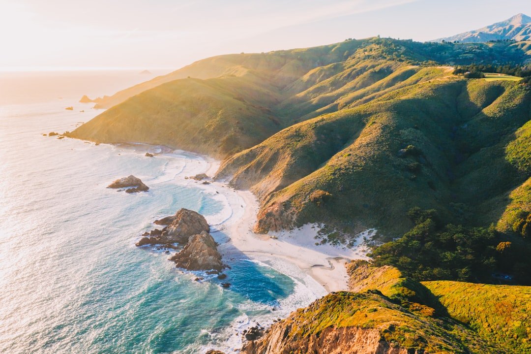
Then, two Septembers ago, I went back on a whim. The sky over the Santa Lucia range was the color of a lake. The ocean was actually blue — not gray-blue, not promising-blue, but the impossible cobalt that shows up on Big Sur postcards and makes you assume someone bumped the saturation. A condor crossed the road canyon near Julia Pfeiffer Burns State Park at eye level, close enough that I could see its wing tags without optics. Nobody talks about this window. Everyone suffers through the fog of summer or the storm roulette of winter, and they skip the exact fortnight when the coast turns itself on.
Mid-September through early October is Big Sur’s clearest, warmest, most honest season. Here’s the field guide I’ve built from four fall trips, including where to point the car, what to pack for a coast that runs 30 degrees between shade and sun, and how to dodge the one road headache that can scramble your whole itinerary.
Why the Fog Machine Finally Shuts Off
The short version is that summer’s marine layer is a temperature standoff. Hot inland valleys pull cold Pacific air onshore all July and August, and the moisture in that air condenses into fog right where you planned to take your vacation photos. In September, the inland heat breaks first. The pressure gradient relaxes, the onshore push weakens, and the fog bank retreats offshore — sometimes sitting a few miles out to sea like a wall you can see from the headlands, with blue sky directly overhead.
The practical payoff is the best visibility of the year, warmer afternoons than June or July, and ocean sunsets that actually commit to the bit. Locals treat September and early October as their reward for surviving tourist season. The other payoff is crowds: school is back in session, so midweek especially, the pullouts and trailheads breathe. You’ll share Bixby Bridge with maybe a dozen people at sunset instead of a hundred.
If you want to go deeper on overlooked corners of this state, our piece on secret California spots the locals keep pairs well with this drive — two of the fifteen are within an hour of it.
The Drive: Seventy-One Miles That Earn Their Reputation
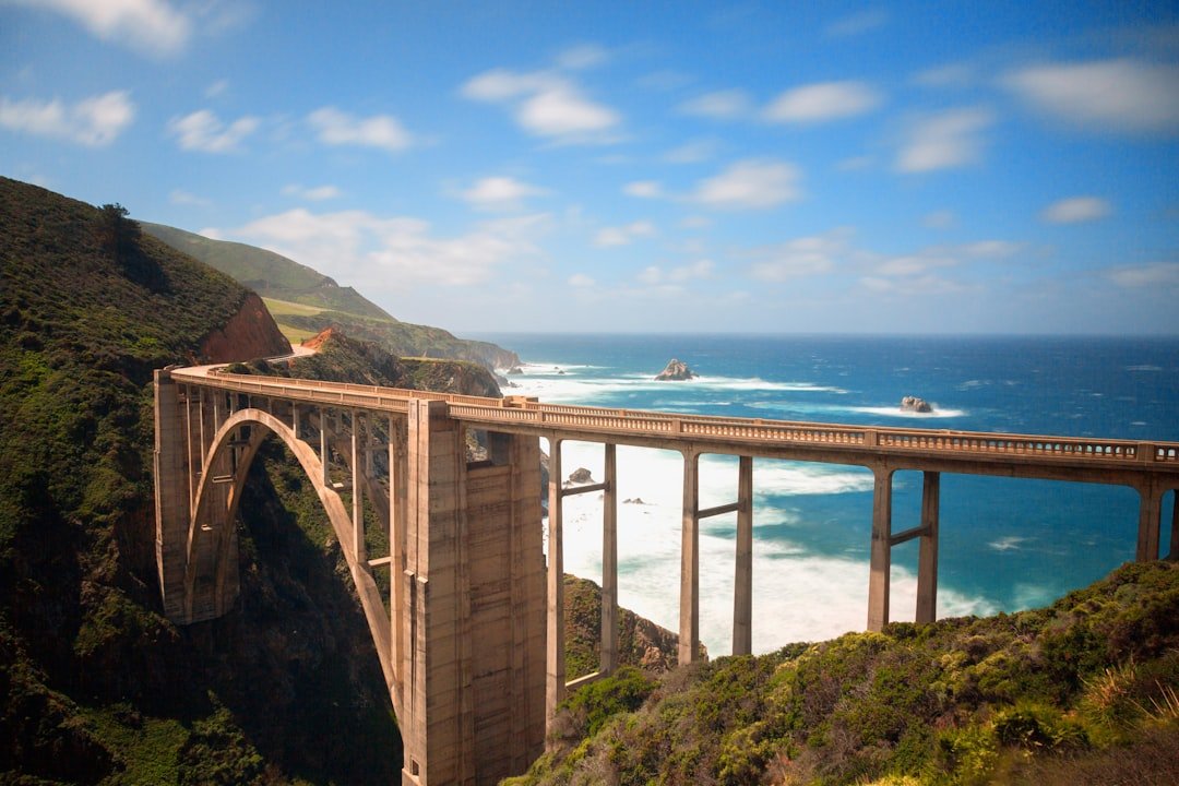
The classic run starts in Carmel-by-the-Sea and ends wherever your patience does — Cambria if you’re completing the whole stretch, Ragged Point if you want a dramatic turnaround. The first hour is the greatest-hits segment: Carmel River State Beach, Point Lobos (worth its own half-day, and it fills to capacity even in shoulder season, so arrive before 10 a.m.), and then Bixby Bridge, the 1932 concrete arch that shows up on more California license-plate art than any other structure.
Here’s the September-specific advice: hit Bixby in the last ninety minutes of daylight. The sun drops behind the ridgeline and lights the span from the side, the crowds thin, and you can walk the old canyon road turnout below the bridge nearly alone. I keep a suction-mount car phone holder on the windshield for exactly this stretch — Highway 1 demands both hands and both eyes, and fumbling for a drifting phone in a hairpin is how side mirrors die.
Before you crown any other American drive, give this one a clear-sky hour. My windshield tour notes from last fall clocked it: eleven substantial photo pullouts in the first forty miles, and on a Tuesday in late September, exactly zero of them required waiting. A year earlier, in August fog, I’d driven the same forty miles photographing a gray void. Same road, different month, entirely different coast.
The One Thing That Can Wreck Your Itinerary
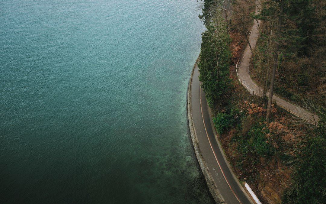
Big Sur’s highway is a living thing. Slides take out lanes, and Caltrans runs maintenance closures that flip sections to one-way traffic control. As of this month, there’s daytime one-way control south of Big Creek Bridge near Lucia on weekdays — expect delays if you’re running the full route to Cambria. That’s routine, not catastrophic, but the smart move is checking the Caltrans QuickMap the morning you drive, because a closure can turn a 90-minute segment into a four-hour detour over Nacimiento-Fergusson Road or force you to backtrack.
Build slack into any Big Sur day. I plan one anchor per morning and one per afternoon, with the space between them left deliberately unscheduled. The coast rewards the unhurried and punishes the tightly-booked.
Pfeiffer Beach and the Keyhole Arch
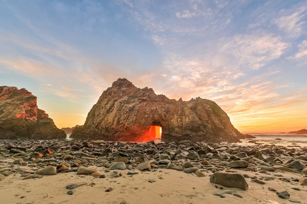
The turn onto Sycamore Canyon Road is unmarked, which is the first filter. The second filter is the road itself — narrow, one lane in stretches, descending through fern canyons to a cove most visitors never find. Pfeiffer Beach is where manganese-heavy sand glows purple-ish at the waterline, and where a rock formation just offshore punches a perfect keyhole through the headland.
In September, the light show at the arch is at its best. Late afternoon sun streams through that keyhole and turns the water inside it to hammered gold — photographers set up tripods for it an hour early, and this is genuinely one of the few places where I’ll say the crowd is worth joining. A lightweight travel tripod earns its trunk space here, and if you time it right, you get the shot and a beach mostly to yourself afterward.
The surf at Pfeiffer is sneaky-strong. Keep kids and dogs well above the wash line, and never turn your back on it. This is a picnic beach, not a swimming beach — bring layers, because even in September the onshore breeze after 4 p.m. has teeth once the sun drops behind the ridge.
McWay Falls and the Waterfall You Can’t Touch
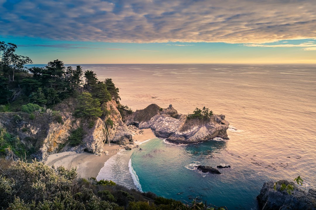
Eighty feet up the canyon wall in Julia Pfeiffer Burns State Park, McWay Creek runs out of redwood country and simply lets go — a thread of white water falling onto a beach so postcard-perfect it looks rendered. The overlook is a quarter mile from the lot on flat pavement. You can’t reach the beach itself, and that’s the point: it’s stayed this pristine because everyone agrees to look, not trample.
Morning light hits the falls from the east; late afternoon lights the cove’s water. In the September fog-free window, you get both without compromise. On my last trip we lingered at the overlook a full hour because the condor flight line passes directly over this canyon — more on that below.
The Redwoods Part Everyone Rushes
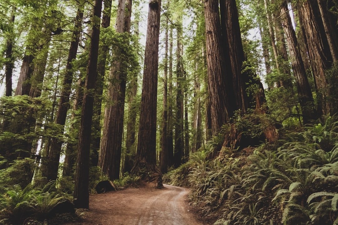
Pfeiffer Big Sur State Park sits where the redwood belt meets the coast, and its valley-floor groves are the quietest corners of the whole region once tour buses roll through. The Pine Ridge Trail’s first two miles follow the Big Sur River through second-growth redwoods that survived the 2020 Dolan Fire’s edges; look for the fire scars on the canyon walls and the impossibly green regrowth underneath them. Redwoods are survivors. It’s a good reminder that this coast rebuilds itself on its own schedule.
Even in September’s warmth, the redwood canyons run cool and dim — ten degrees colder than the headlands, easy. I carry a merino base layer set in the daypack year-round on this coast, and the moment a trail drops into a canyon, it goes on. Cotton that’s damp from a morning sweat chill gets dangerous by sundown; merino just works.
Condor Country: The Sky Has Wildlife Now
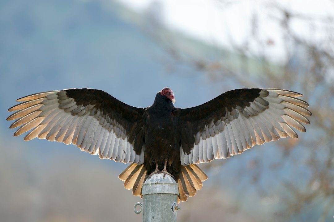
The California condor was down to 22 individuals in the 1980s. Big Sur’s central coast flock is one of the species’ strongholds, and September’s clean air makes it the best month to spot them. They patrol the thermals along the Highway 1 cliffs between Big Sur Valley and Lucia, nine-foot wingspans held flat as boards, riding updrafts without a single wingbeat. The tell is size: if you’re wondering whether that bird is big enough to be a condor, it’s a turkey vulture. When you genuinely can’t believe a bird can be that big, it’s a condor.
You’ll see plenty of vultures too — they teeter in the thermals with wings in a shallow V, tipping constantly. Condors hold flat and steady, like a B-52 that missed its turn. A compact pair of 12×25 binoculars lives in my console for exactly this stretch of coast, and it’s pulled double duty on whale spouts: September humpbacks feed within sight of shore, and on a clear fall day the spouts are visible from headlands like Hurricane Point with nothing but glass. For a deeper California wildlife fix, America’s Galapagos sits a few hours down the coast, and its September window is nearly as good as this one.
Where to Sleep When the Fog’s Gone
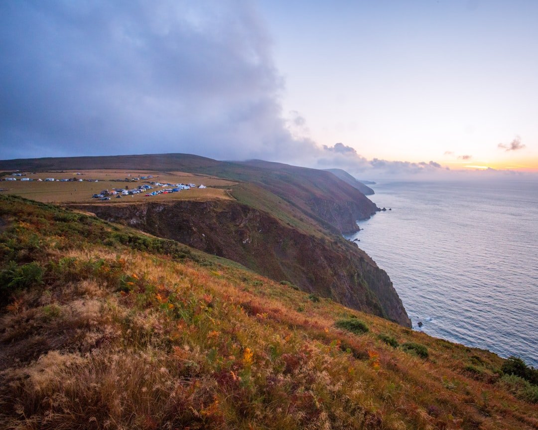
This is the part where September gets tricky, because everyone who knows about September also knows about the campgrounds. Kirk Creek Campground sits on a bluff 800 feet above the ocean, and its sunset-over-the-Pacific sites are arguably the best car-camping view in California. They book out months ahead for fall weekends. Your play is midweek: Sunday through Thursday nights open up dramatically, and a clear September Tuesday at Kirk Creek will ruin every other campground for you. It did for me.
Two anchor rules for Big Sur nights. First, coastal temps swing 30 degrees between afternoon sun and evening fog-shadow — even in September I’m in a sun protection hoodie by day and three layers by the campfire. Second, never arrive after dark; the highway is unforgiving at night and campsite turnouts are easy to miss. A rechargeable headlamp per person is non-negotiable if you’re doing anything past sunset, which you will be, because the stars over this coast in September — with the marine layer offshore — are outrageous.
If hotels are more your speed, Big Sur’s lodges run shoulder-season rates once summer ends, but “shoulder season” pricing here still means booking a couple of weeks out for weekends. The alternative that’s worked for my crew: base in Carmel or Cambria and drive the interior of the route, sleeping at the edges where beds multiply.
The Picnic Strategy That Beats Every Restaurant Wait
Nepenthe’s terrace, 808 feet above the breaking waves, is a religious experience with a burger menu — but on clear September days the wait can stretch past an hour. Our workaround: we eat one meal there (go at 11:30 a.m. sharp) and build the other day’s meals from the Big Sur River Inn general store or a pre-packed cooler. A 30-can soft-sided cooler loaded in Carmel keeps cheese, fruit, and drinks cold through two days of stops, and a big waterproof picnic blanket turns any of the unsigned bluff pullouts into the best table in California. Some of my favorite meals on this coast cost twelve dollars and came with a thousand-foot drop and no waitlist.
The Two-Night Playbook
Day one: Carmel start, Point Lobos by 9 a.m., Bixby Bridge photos, lunch in Big Sur Valley, redwoods in Pfeiffer Big Sur SP by mid-afternoon, sunset at a south-facing pullout. Sleep — Kirk Creek if you won a site, Cambria if you didn’t. Day two: McWay Falls at opening, Pfeiffer Beach for the keyhole light at 4:30 p.m., condor glassing anywhere along the Lucia cliffs between. Build the driving around the light and everything else falls into place.
Carry more water than feels reasonable — a 32-ounce insulated bottle per person gets refilled at spigots in the state parks, and September’s dry warmth sneaks up on people who dressed for fog-season Big Sur. Pack it all in a 20-liter daypack and leave the rest in the car; trailhead parking fills even in shoulder season, and the pass (Ewoldsen, Pine Ridge’s first miles) is where you want to be on foot anyway.
Why This Window, Every Year
I’ve chased shoulder seasons all over the continent — the aspen clock in the Eastern Sierra, the quiet weeks at national parks, even California’s other volcano park at its summer peak. Big Sur in late September remains my favorite two-week window on the calendar, because it’s the rare case where the best weather, the thinnest crowds, and the most dramatic light all stack into the same fortnight. It’s the coast as its own postcards promise, minus the fog that ate my three summers.
Go midweek if you possibly can. Check the road status the morning of. Park legal, layer up, and give Bixby your last hour of daylight. The condors have it figured out — they don’t waste energy fighting the conditions; they wait for the sky to open and then ride it. In September, Big Sur’s sky opens. Be there when it does.