Somewhere around the second week of October, the American travel machine points itself at New England, lets the national parks empty out, and starts drafting gift guides. Death Valley National Park spends that same week quietly turning its lights back on. The Inn at Furnace Creek, dark through the worst of the heat, reopens for the season. The campgrounds that board up in summer pull their seasonal-closure signs. And a valley that spent five months as one of the least hospitable inhabited places on the planet goes back to being what it is the rest of the time: the biggest, strangest, quietest playground in the American West.
I learned the pattern by accident, on a July drive through the same desert that once pushed me into a campervan cooling strategy born of pure desperation. That trip taught me what 119 degrees does to a bag of trail mix. My team and I came back the following October and barely recognized the place — same furnace, half the heat, ten times the life. Now I plan the whole year around it.
Here is the field guide I wish someone had handed me before that first October, updated for the fall of 2026 — including one road you should not put off any longer.
A Season That Runs Backwards
Every other park in the country peaks in summer and closes its books by Labor Day. Death Valley files its paperwork in reverse. The clearest signal is a campground: Furnace Creek Campground runs first-come, first-served through the blazing months, then flips to reservation-only on October 15 and stays that way until April 15. That date is the park’s unofficial opening day, and locals treat it like one.
The weather follows. Early October still throws daytime highs in the 90s — the park stays honestly warm while the rest of the country breaks out flannel. By Halloween the average high settles into the 80s, and November delivers daytime 70s with nights in the 40s and 50s. That is sleeping weather. That is also hiking weather, in a park where summer hiking is genuinely dangerous rather than merely uncomfortable.
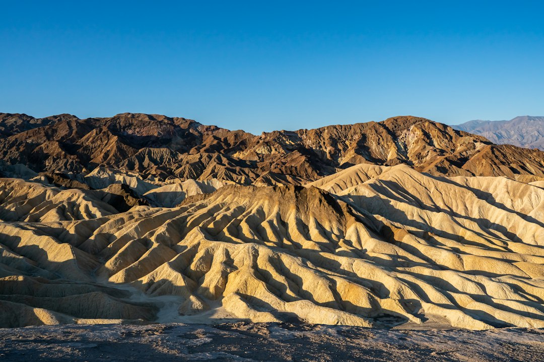
And here is the part that still surprises people: there is no timed-entry system, no lottery, no shuttle queue, no 5 a.m. scramble for a parking spot at a trailhead. The park’s answer to October crowds is that it doesn’t have any. You will share Zabriskie Point at sunrise with a handful of photographers and a German couple who clearly read a better guidebook than yours.
Titus Canyon Closes October 1 for a Full Year
The single piece of news that should reorder your plans this fall: the National Park Service will close Titus Canyon Road on October 1, 2026, for repairs that run through September 30, 2027. After years of storm damage, the road is temporarily open right now — with occasional day closures — but the countdown to a full year of no access is measured in days, not months.
If the name doesn’t ring a bell, understand that Titus Canyon is not a road to an attraction; the road is the attraction. Twenty-seven miles of one-way dirt track that begins outside Beatty, Nevada, climbs over a 5,200-foot pass, threads the rusting remains of the Leadfield ghost town, and finally drops into a limestone canyon that tightens until the walls tower a few hundred feet over your roof rack and the roadbed narrows to a single lane of compacted gravel. My route scout calls it the best hour of slow driving in California, and she is not a person who hands out compliments.
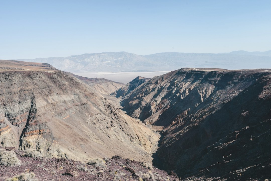
The closure is part of a bigger story. This valley’s road network is still living through the aftermath of repeated flooding — the 2015 storm that gutted Scotty’s Castle, the August 2023 deluge, and last fall’s storms that tore up roads again. Scotty’s Castle and Bonnie Clare Road remain closed with no reopening date. The Darwin Falls road is effectively gone until at least summer 2027, though hikers can still walk in from the shoulder of CA-190. Check the park’s Alerts and Conditions page the same week you travel, not the month before. In this park, the road report is the news.
The Opening-Weeks Loop, Sunrise to Sunset
The first cool weeks reward a simple loop built around light, because the light here is the headliner. Our crew runs a version of this every year; it compresses the park’s greatest hits into one long, gorgeous day.
First Light: Zabriskie and the Badlands
Be at Zabriskie Point twenty minutes before the sun clears the Black Mountains. The eroded badlands catch first light in ridges of ochre and bone white, and the crowd — small, in October — audibly gasps when it happens. Then drop down into Golden Canyon and link up with Gower Gulch for a four-mile loop through canyon walls that shift from gold to rust to something close to burgundy as the sun climbs. By mid-morning you’ll understand why the park service calls this the most popular hike in Death Valley, and you’ll be grateful the popular months are still five months of furnace away.
Midday: The Salt Floor at Badwater
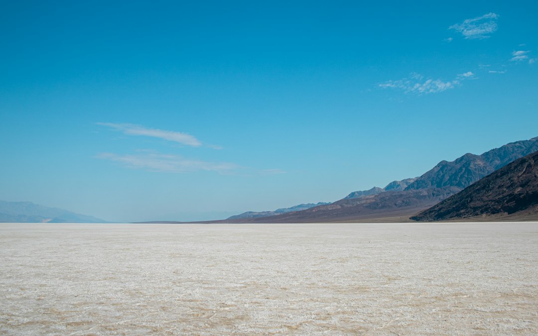
At 282 feet below sea level, Badwater Basin is the lowest point in North America, a white plain of salt polygons that runs to the horizon like a frozen sea. In July, walking out onto it at noon is a stunt. In late October, it’s just a walk — still fierce, still shimmering, but survivable, which changes everything. One road note from this year’s conditions report: the pavement south of Badwater toward Shoshone is rough, with loose gravel and soft shoulders from flood repairs, but the basin itself is fully accessible from the north.
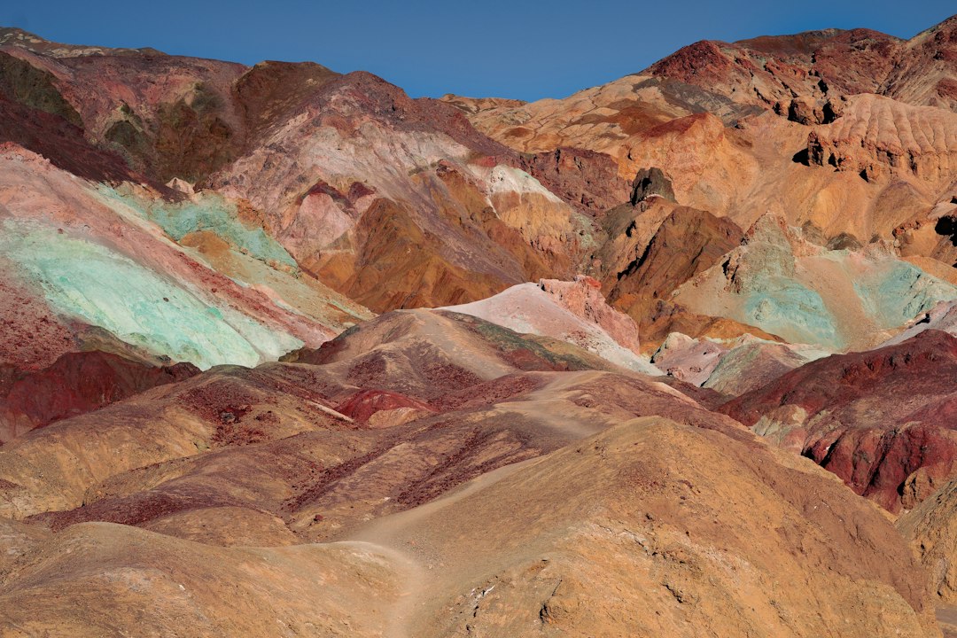
On the way back up the valley, take the one-way Artist’s Drive, nine paved miles through hills banded in green, pink, and violet by mineral stains. The palette really does look painted. Pull off at the actual Artist’s Palette formation around mid-afternoon, when the colors are at their loudest.
Dusk: Mesquite Flat and the Singing Sand
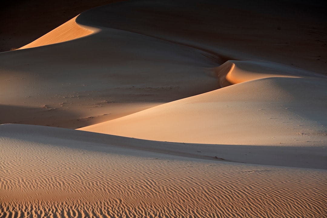
Finish at the Mesquite Flat Sand Dunes, fifteen minutes from Stovepipe Wells, and time it for the last hour of daylight. The highest ridges are a stiff twenty-minute climb, and from the crest you get the whole valley as the light goes long and pink. Then there’s the odd bonus: these are some of the famous singing dunes, and when dry sand avalanches down a steep face — sometimes set off by your own boots sliding down — it can produce a low booming tone. Our photographer spent twenty minutes sliding on purpose before she got the sand to talk.
The Sky Turns Itself Inside Out
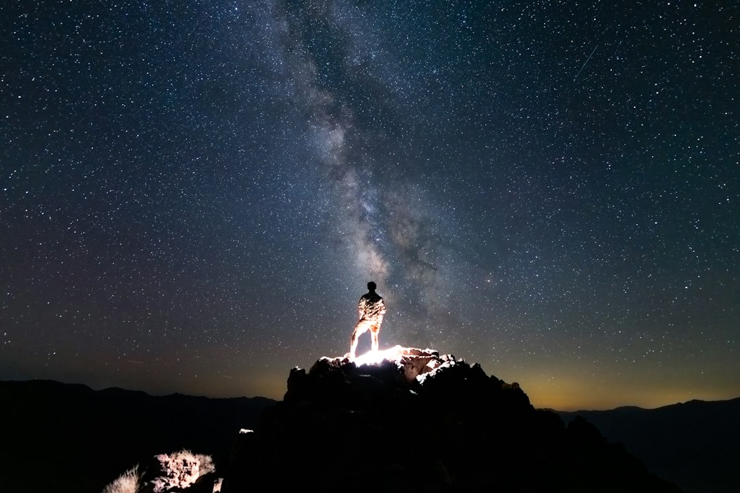
Here is the quiet truth about October: the long, furnace-grade days are shrinking, and that is precisely the product. Death Valley is a Gold Tier International Dark Sky Park — the highest rating there is — and fall is when the viewing season starts in earnest. Nights are long enough for real sessions, but still warm enough that you’re not standing at a telescope in a parka. In early evening, the summer Milky Way core is still hanging over the horizon; by November it sinks early and the dark winter constellations take over.
You don’t need a secret spot. Drive twenty minutes off Furnace Creek’s glow — toward the dunes, toward Badwater, up toward Wildrose — kill the engine, and wait the ten minutes your eyes need. The first time I did it, the Milky Way was bright enough to cast a shadow on the sand, and I understood why people fly across oceans for this. We run the same red-light-only discipline at camp that we use for chasing meteor showers under dark skies, and it takes exactly one night to convert anyone. A headlamp with a true red-light mode — we carry the rechargeable LHKNL headlamps — keeps your night vision intact for the whole camp.
Rough Roads and the Art of Airing Down
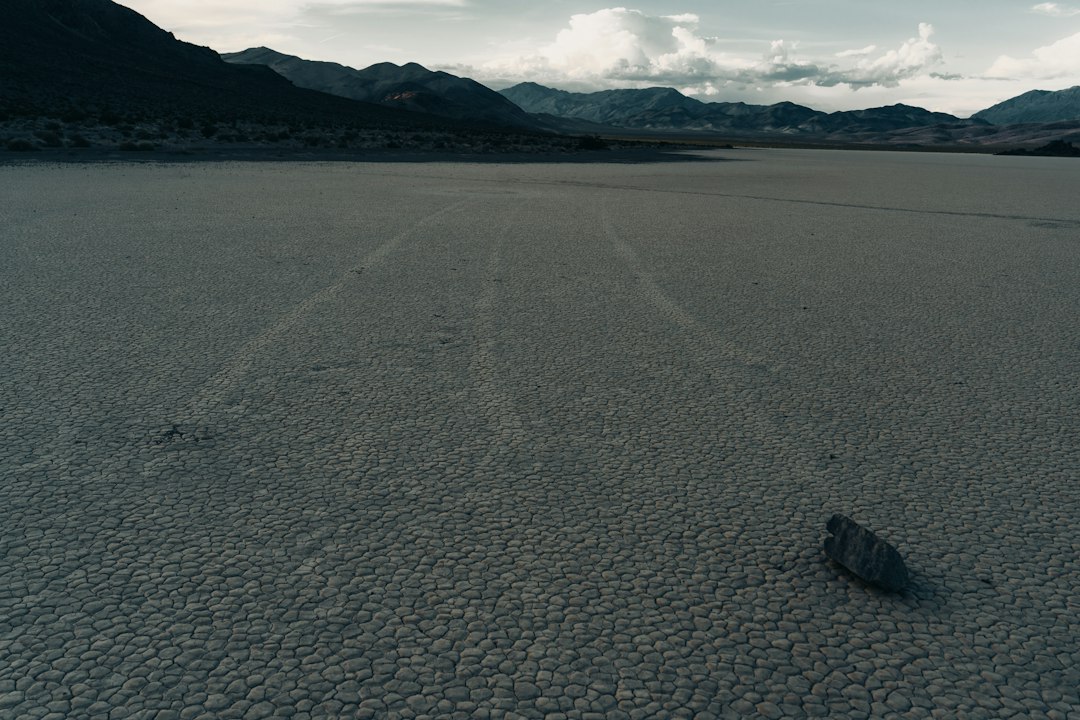
The Racetrack is the valley’s famous backcountry trophy: a perfectly flat cracked-clay playa where rocks appear to have sailed across the surface, leaving trails like tiny boat wakes. (The mystery was solved in 2014 — thin panels of winter ice form around the stones, catch the wind, and shove them along when the playa is wet — but knowing the trick doesn’t subtract an ounce from standing there.) The catch is the drive: 27 miles of brutal washboard gravel each way from Ubehebe Crater, with zero services and zero cell coverage. High clearance is strongly advised, and patience is mandatory.
The single biggest comfort upgrade on a road like that is letting air out of your tires. Dropping into the low twenties softens the washboard dramatically and keeps your suspension from being hammered into gravel milkshake; we run a JACO RapidFlow deflator with a built-in gauge so the whole process takes four minutes a corner, then reinflate before touching pavement again. This year’s conditions report adds a few asterisks: Hunter Mountain Road is closed after repeated stuck vehicles, Harry Wade Road has a deep-sand section about six miles south of Badwater Road, and Lower Wildrose is passable in most vehicles but bans anything over 25 feet. Over in remote Saline Valley, the Palm Springs campground is open, though the Lower Springs area is closed following a mid-September wildfire.
Camping the First Cool Weeks
The campground map in October reads like a slowly opening theater. Furnace Creek — 136 sites, 18 with hookups — switches to reservations on the 15th through recreation.gov. Mesquite Spring up north stays first-come and has water, which makes it our fallback favorite. Wildrose is open but dry, pack it in. The primitives — Thorndike, Mahogany Flat, Eureka Dunes, Homestake — are free, gorgeous, and increasingly cold as you climb; Mahogany Flat at 8,200 feet can freeze any night of the year. The seasonal campgrounds at Stovepipe Wells, Sunset, and Texas Springs reopen as staffing allows around mid-month, so check current status before you count on them.
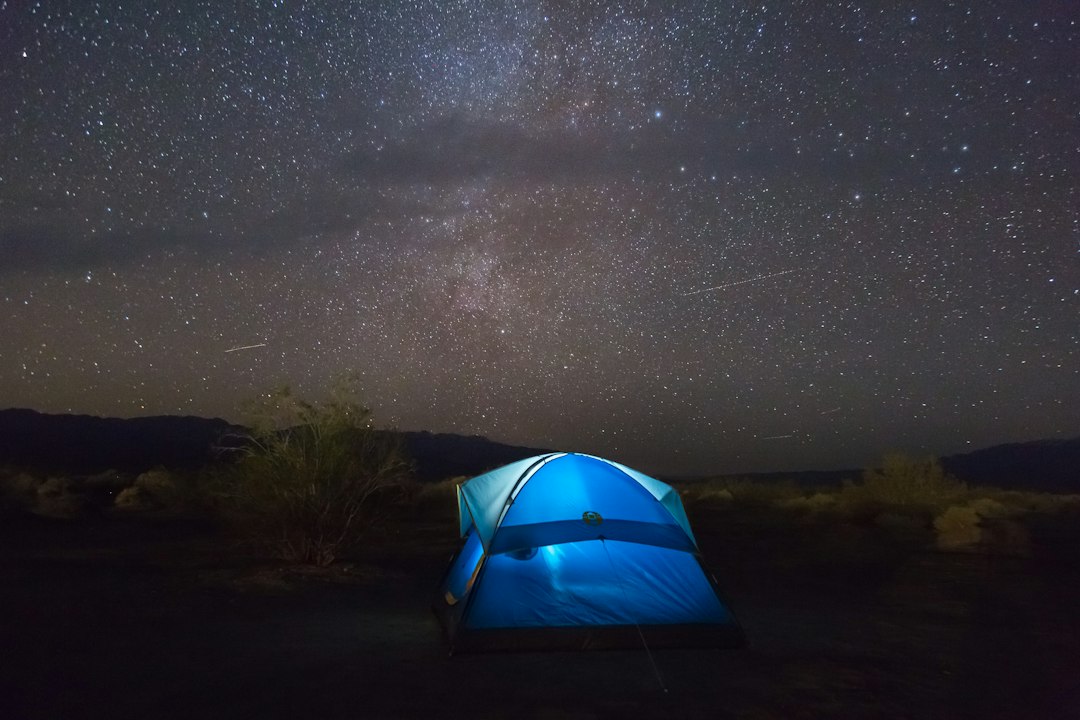
Nights are the surprise. After an 85-degree day, the mercury can slide into the 40s, and I’ve seen more people shiver in Death Valley in October than sweat in it. This is exactly the shoulder-season whiplash that my packable down kit was built for — a jacket that vanishes into a daypack at ten in the morning and earns its keep at seven. Around camp, a windproof ground blanket like the REDCAMP stadium blanket does double duty as a picnic layer for the dunes at dusk and a late-night barrier between you and a camp chair that’s radiating your own heat into space.
Water, Fuel, and the Math of Distance
Death Valley is the largest national park in the lower 48 — 3.4 million acres — and the scale rearranges your planning. Distances that look trivial on the map are real drives: Furnace Creek to the Racetrack is a hundred-mile round trip on gravel, Eureka Dunes is a hundred miles one-way, and a Badwater-to-Ubehebe day out and back will run you past 150 miles without trying. Fuel is available around the clock at Furnace Creek and Stovepipe Wells, at prices that sting; top off in Pahrump, Beatty, or Lone Pine and treat in-park gas as insurance rather than strategy. Entrance runs $30 per vehicle for seven days.
Water discipline doesn’t end with summer. The park service recommends a gallon per person per day as a floor, more if you’re hiking, and our crew carries two 32-ounce insulated bottles per person — the Owala FreeSip has become the van default because the lid survives being dropped on gravel. Cell coverage is effectively nonexistent outside the developed areas, so we carry a Garmin inReach Mini 2 for weather updates and the one text that matters if a washboard road eats a tire. And after watching GPS apps route people onto roads that no longer exist, I’ll say this plainly: a paper map is not nostalgia here. The National Geographic Trails Illustrated map of the park is waterproof, shows road conditions conventions, and never loses signal.
The Kit That Earns Its Spot in October
The sun at 282 feet below sea level does not know what month it is. UV is still UV, and the desert’s dry air will dehydrate you while you’re admiring the view. Short version of everything our team has dialed in over four Octobers:
- Sun hat with a neck flap. A wide brim alone leaves your neck cooking by 11 a.m.; we use packable UPF 50+ hats with drop-down flaps that stuff into a door pocket.
- Cooling neck gaiter. Wet it, wring it, wear it on the salt flats at noon — the multi-pack gaiters are cheap enough that everyone in the van gets two.
- Electrolytes, not just water. Plain water alone can’t fix what dry heat takes out of you; Nuun tablets dropped into a bottle keep the afternoon slump off the itinerary.
- A real headlamp, with red mode. One per person — dark-sky etiquette only works if everyone plays.
- Layers for a 40-degree daily swing. Sun shirt at noon, down jacket at dusk, blanket at camp.
The Twenty-Four Hours You Can’t Get Anywhere Else
Stand at Badwater at noon with your sleeves rolled up. Watch the Milky Way cast a shadow on the dunes at nine. Sleep in a tent that needs both a sun hat and a down jacket packed beside it. There is no other park in the country — maybe no other place on the continent — where those three sentences describe a single October day. The valley has spent all year saving it for you.
Book the campsite now, watch the road report, and if Titus Canyon is on your list, let this be the nudge: a full year without it starts October 1. And be warned — fall for this valley once in its opening weeks, and you’ll find yourself doing what we did: quietly planning the desert superbloom chase come spring, because October is how they get you.